Mount Blackmore Topo Map Montana
To zoom in, hover over the map of Mount Blackmore
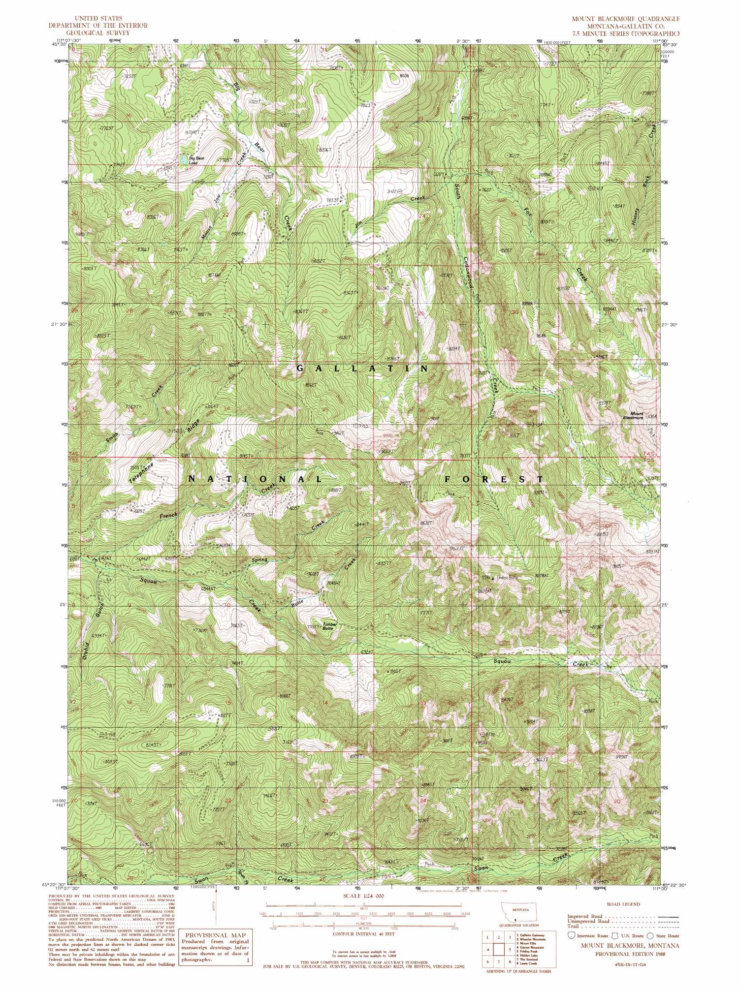
USGS Topo Quad 45111d1 - 1:24,000 scale
| Topo Map Name: | Mount Blackmore |
| USGS Topo Quad ID: | 45111d1 |
| Print Size: | ca. 21 1/4" wide x 27" high |
| Southeast Coordinates: | 45.375° N latitude / 111° W longitude |
| Map Center Coordinates: | 45.4375° N latitude / 111.0625° W longitude |
| U.S. State: | MT |
| Filename: | o45111d1.jpg |
| Download Map JPG Image: | Mount Blackmore topo map 1:24,000 scale |
| Map Type: | Topographic |
| Topo Series: | 7.5´ |
| Map Scale: | 1:24,000 |
| Source of Map Images: | United States Geological Survey (USGS) |
| Alternate Map Versions: |
Mount Blackmore MT 1988, updated 1988 Download PDF Buy paper map Mount Blackmore MT 1988, updated 1988 Download PDF Buy paper map Mount Blackmore MT 2000, updated 2005 Download PDF Buy paper map Mount Blackmore MT 2011 Download PDF Buy paper map Mount Blackmore MT 2014 Download PDF Buy paper map |
| FStopo: | US Forest Service topo Mount Blackmore is available: Download FStopo PDF Download FStopo TIF |
1:24,000 Topo Quads surrounding Mount Blackmore
Anceney |
Bozeman Hot Springs |
Bozeman |
Kelly Creek |
Bozeman Pass |
Ruby Mountain |
Gallatin Gateway |
Wheeler Mountain |
Mount Ellis |
Bald Knob |
Beacon Point |
Garnet Mountain |
Mount Blackmore |
Fridley Peak |
Big Draw |
Gallatin Peak |
Hidden Lake |
The Sentinel |
Lewis Creek |
Dailey Lake |
Ousel Falls |
Lone Indian Peak |
Ramshorn Peak |
Miner |
Dome Mountain |
> Back to 45111a1 at 1:100,000 scale
> Back to 45110a1 at 1:250,000 scale
> Back to U.S. Topo Maps home
Mount Blackmore topo map: Gazetteer
Mount Blackmore: Lakes
Big Bear Lake elevation 2245m 7365′Mount Blackmore: Ridges
Telephone Ridge elevation 2322m 7618′Mount Blackmore: Streams
Butte Creek elevation 1992m 6535′Fox Creek elevation 2023m 6637′
French Creek elevation 1867m 6125′
Jim Creek elevation 2017m 6617′
Moose Jaw Creek elevation 2162m 7093′
South Fork Swan Creek elevation 1951m 6400′
Spring Creek elevation 1949m 6394′
Mount Blackmore: Summits
Alex Lowe Peak elevation 3054m 10019′Amber Butte elevation 2684m 8805′
Kinor Peak elevation 2736m 8976′
Mount Blackmore elevation 3064m 10052′
Mount Blackmore: Valleys
Orchid Gulch elevation 1903m 6243′Mount Blackmore digital topo map on disk
Buy this Mount Blackmore topo map showing relief, roads, GPS coordinates and other geographical features, as a high-resolution digital map file on DVD: