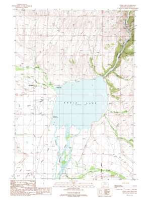
Ennis Lake Topo Map Montana
To zoom in, hover over the map of Ennis Lake
USGS Topo Quad 45111d6 - 1:24,000 scale
| Topo Map Name: | Ennis Lake |
| USGS Topo Quad ID: | 45111d6 |
| Print Size: | ca. 21 1/4" wide x 27" high |
| Southeast Coordinates: | 45.375° N latitude / 111.625° W longitude |
| Map Center Coordinates: | 45.4375° N latitude / 111.6875° W longitude |
| U.S. State: | MT |
| Filename: | o45111d6.jpg |
| Download Map JPG Image: | Ennis Lake topo map 1:24,000 scale |
| Map Type: | Topographic |
| Topo Series: | 7.5´ |
| Map Scale: | 1:24,000 |
| Source of Map Images: | United States Geological Survey (USGS) |
| Alternate Map Versions: |
Ennis Lake MT 1988, updated 1989 Download PDF Buy paper map Ennis Lake MT 1988, updated 1989 Download PDF Buy paper map Ennis Lake MT 1997, updated 2002 Download PDF Buy paper map Ennis Lake MT 2011 Download PDF Buy paper map Ennis Lake MT 2014 Download PDF Buy paper map |
| FStopo: | US Forest Service topo Ennis Lake is available: Download FStopo PDF Download FStopo TIF |
1:24,000 Topo Quads surrounding Ennis Lake
> Back to 45111a1 at 1:100,000 scale
> Back to 45110a1 at 1:250,000 scale
> Back to U.S. Topo Maps home
Ennis Lake topo map: Gazetteer
Ennis Lake: Canals
West Madison Canal elevation 1512m 4960′Ennis Lake: Dams
Madison Dam elevation 1686m 5531′Ennis Lake: Lakes
Ennis Lake elevation 1469m 4819′Ennis Lake: Populated Places
McAllister elevation 1496m 4908′Watkins elevation 1472m 4829′
Ennis Lake: Post Offices
McAllister Post Office elevation 1496m 4908′Spalding Post Office (historical) elevation 1497m 4911′
Ennis Lake: Reservoirs
Lake Ennis elevation 1686m 5531′Ennis Lake: Streams
Barn Creek elevation 1469m 4819′Cedar Creek elevation 1484m 4868′
Crooked Creek elevation 1560m 5118′
Fall Creek elevation 1486m 4875′
Fletcher Channel elevation 1469m 4819′
Fletcher Creek elevation 1512m 4960′
Jack Creek elevation 1483m 4865′
Jourdain Creek elevation 1469m 4819′
Moore Creek elevation 1469m 4819′
North Meadow Creek elevation 1470m 4822′
Saint Joe Creek elevation 1469m 4819′
Short Creek elevation 1511m 4957′
South Meadow Creek elevation 1471m 4826′
Spring Branch elevation 1476m 4842′
Spring Creek elevation 1665m 5462′
Trail Creek elevation 1476m 4842′
Ennis Lake: Valleys
Bear Trap Canyon elevation 1500m 4921′Ennis Lake: Wells
04S01W35AADD01 Well elevation 1474m 4835′05S01W03ACCC01 Well elevation 1478m 4849′
05S01W04ABDD01 Well elevation 1493m 4898′
05S01W04ACBC01 Well elevation 1495m 4904′
05S01W04BAAB01 Well elevation 1497m 4911′
05S01W04DBAB01 Well elevation 1494m 4901′
05S01W04DDDB01 Well elevation 1495m 4904′
05S01W10BADC01 Well elevation 1490m 4888′
05S01W17AAAA01 Well elevation 1507m 4944′
05S01W21CCCC01 Well elevation 1516m 4973′
05S01W21DCDB01 Well elevation 1496m 4908′
05S01W23CCBD01 Well elevation 1484m 4868′
05S01W23DABA01 Well elevation 1493m 4898′
05S01W28BCAB01 Well elevation 1497m 4911′
Ennis Lake digital topo map on disk
Buy this Ennis Lake topo map showing relief, roads, GPS coordinates and other geographical features, as a high-resolution digital map file on DVD:


