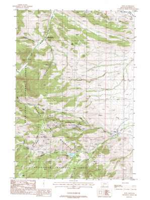
Pony Topo Map Montana
To zoom in, hover over the map of Pony
USGS Topo Quad 45111f8 - 1:24,000 scale
| Topo Map Name: | Pony |
| USGS Topo Quad ID: | 45111f8 |
| Print Size: | ca. 21 1/4" wide x 27" high |
| Southeast Coordinates: | 45.625° N latitude / 111.875° W longitude |
| Map Center Coordinates: | 45.6875° N latitude / 111.9375° W longitude |
| U.S. State: | MT |
| Filename: | o45111f8.jpg |
| Download Map JPG Image: | Pony topo map 1:24,000 scale |
| Map Type: | Topographic |
| Topo Series: | 7.5´ |
| Map Scale: | 1:24,000 |
| Source of Map Images: | United States Geological Survey (USGS) |
| Alternate Map Versions: |
Pony MT 1988, updated 1988 Download PDF Buy paper map Pony MT 1996, updated 1998 Download PDF Buy paper map Pony MT 2011 Download PDF Buy paper map Pony MT 2014 Download PDF Buy paper map |
| FStopo: | US Forest Service topo Pony is available: Download FStopo PDF Download FStopo TIF |
1:24,000 Topo Quads surrounding Pony
> Back to 45111e1 at 1:100,000 scale
> Back to 45110a1 at 1:250,000 scale
> Back to U.S. Topo Maps home
Pony topo map: Gazetteer
Pony: Canals
South Fork Missouri Ditch elevation 1514m 4967′Pony: Dams
Cataract Creek Dam elevation 1935m 6348′Marsh Lake Dam elevation 2516m 8254′
Pony: Gaps
Windy Pass elevation 2452m 8044′Pony: Lakes
Cataract Lake elevation 1935m 6348′Pony: Mines
Atlantic and Pacific Mine elevation 2334m 7657′Bear Gulch Mine elevation 2161m 7089′
Ben Harrison Mine elevation 2682m 8799′
Boss Tweed Mine elevation 2266m 7434′
Boss Tweed Mine elevation 2219m 7280′
Clipper Mine elevation 2426m 7959′
Garnet Gold Mine elevation 2122m 6961′
Garnet Gold Mine elevation 1966m 6450′
Gilliam Vermiculite Mine elevation 1894m 6213′
Lone Wolf Mine elevation 2423m 7949′
Mount Cliff Mine elevation 2415m 7923′
Mountain Cliff Mine elevation 2386m 7828′
Mountain Meadow Mine elevation 2173m 7129′
Mountain Meadow Mine elevation 2186m 7171′
NE NW Section 24 Mine elevation 1876m 6154′
NE NW Section 34 Mine elevation 1864m 6115′
NW NE Section 14 Mine elevation 2016m 6614′
NW NW Section 22 Mine elevation 2415m 7923′
NW SE Section 17 Mine elevation 2465m 8087′
Pony Mine elevation 2418m 7933′
Pony Mine elevation 2263m 7424′
SE NE Section 21 Mine elevation 2261m 7417′
SE NE Section 33 Mine elevation 2016m 6614′
SE NW Section 16 Mine elevation 2681m 8795′
SE NW Section 24 Mine elevation 1876m 6154′
SE SE Section 13 Mine elevation 1876m 6154′
Strawberry Mine elevation 2010m 6594′
Strawberry Mine elevation 2069m 6788′
SW NW Section 18 Mine elevation 1819m 5967′
SW SE Section 18 Mine elevation 1639m 5377′
SW SE Section 34 Mine elevation 2016m 6614′
SW SW Section 16 Mine elevation 2350m 7709′
White Pine Mine elevation 2499m 8198′
Pony: Populated Places
Pony elevation 1684m 5524′Pony: Post Offices
Clipper Post Office (historical) elevation 2426m 7959′Pony Post Office elevation 1684m 5524′
Pony: Reservoirs
Atlantic and Pacific Mine elevation 2322m 7618′Mason Lake elevation 2525m 8284′
Pony: Ridges
Strawberry Ridge elevation 1998m 6555′Pony: Streams
Brownback Creek elevation 1629m 5344′Carmichael Creek elevation 1621m 5318′
Cataract Creek elevation 1776m 5826′
Charcoal Creek elevation 1801m 5908′
Hog Hollow Creek elevation 1535m 5036′
Magpie Creek elevation 1639m 5377′
Pony Creek elevation 1663m 5456′
Pony: Summits
East Butte elevation 2004m 6574′Queens Hill elevation 2547m 8356′
Pony: Valleys
Brownback Gulch elevation 1642m 5387′Carmichael Canyon elevation 1607m 5272′
Sams Gulch elevation 1734m 5688′
Pony: Wells
02S02W18DBCC01 Well elevation 1687m 5534′02S02W18DCAD01 Well elevation 1661m 5449′
Pony digital topo map on disk
Buy this Pony topo map showing relief, roads, GPS coordinates and other geographical features, as a high-resolution digital map file on DVD:


