Three Forks Se Topo Map Montana
To zoom in, hover over the map of Three Forks Se
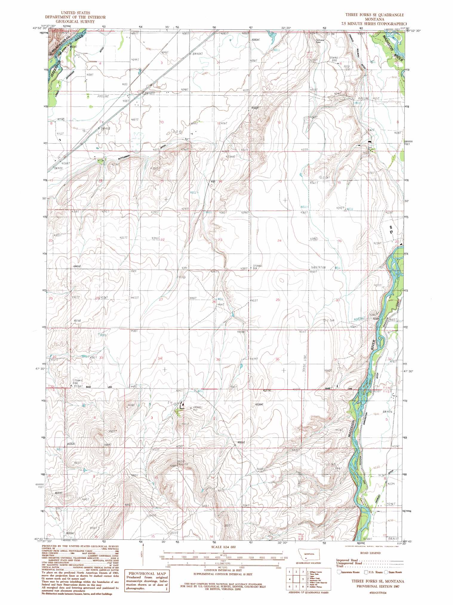
USGS Topo Quad 45111g5 - 1:24,000 scale
| Topo Map Name: | Three Forks Se |
| USGS Topo Quad ID: | 45111g5 |
| Print Size: | ca. 21 1/4" wide x 27" high |
| Southeast Coordinates: | 45.75° N latitude / 111.5° W longitude |
| Map Center Coordinates: | 45.8125° N latitude / 111.5625° W longitude |
| U.S. State: | MT |
| Filename: | o45111g5.jpg |
| Download Map JPG Image: | Three Forks Se topo map 1:24,000 scale |
| Map Type: | Topographic |
| Topo Series: | 7.5´ |
| Map Scale: | 1:24,000 |
| Source of Map Images: | United States Geological Survey (USGS) |
| Alternate Map Versions: |
Three Forks SE MT 1987, updated 1987 Download PDF Buy paper map Three Forks SE MT 2011 Download PDF Buy paper map Three Forks SE MT 2014 Download PDF Buy paper map |
1:24,000 Topo Quads surrounding Three Forks Se
Willow Springs |
Radersburg Sw |
Plunket Lake |
Lombard |
Roy Gulch |
Negro Hollow |
Milligan Canyon |
Three Forks |
Logan |
Nixon Gulch |
Sappington |
Willow Creek |
Three Forks Se |
Manhattan Sw |
Manhattan |
Harrison |
Willow Creek Reservoir |
Norris Ne |
Madison Plateau |
Anceney |
Maltbys Mound |
Norris |
Bear Trap Creek |
Cherry Creek Canyon |
Ruby Mountain |
> Back to 45111e1 at 1:100,000 scale
> Back to 45110a1 at 1:250,000 scale
> Back to U.S. Topo Maps home
Three Forks Se topo map: Gazetteer
Three Forks Se: Canals
Francis Walbert Ditch elevation 1260m 4133′Lower Jefferson Ditch elevation 1251m 4104′
Three Forks Se: Mines
Maltby Mound II Mine elevation 1389m 4557′Three Forks Se: Post Offices
Garfield Post Office (historical) elevation 1333m 4373′Three Forks Se: Wells
01N01E04BCDC01 Well elevation 1251m 4104′01N01E29AAAA01 Well elevation 1358m 4455′
01N02E06BCBA01 Well elevation 1296m 4251′
01N02E06DAA_01 Well elevation 1256m 4120′
01N02E07AACA01 Well elevation 1272m 4173′
01N02E18DCCD01 Well elevation 1325m 4347′
01N02E19CDDD01 Well elevation 1341m 4399′
01N02E20AC__01 Well elevation 1281m 4202′
01N02E30DCAC01 Well elevation 1343m 4406′
01S01E02BBAB01 Well elevation 1379m 4524′
01S02E05AB__01 Well elevation 1283m 4209′
01S02E08CDDC01 Well elevation 1295m 4248′
11S01E25ACBD01 Well elevation 1361m 4465′
Three Forks Se digital topo map on disk
Buy this Three Forks Se topo map showing relief, roads, GPS coordinates and other geographical features, as a high-resolution digital map file on DVD: