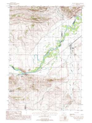
Willow Creek Topo Map Montana
To zoom in, hover over the map of Willow Creek
USGS Topo Quad 45111g6 - 1:24,000 scale
| Topo Map Name: | Willow Creek |
| USGS Topo Quad ID: | 45111g6 |
| Print Size: | ca. 21 1/4" wide x 27" high |
| Southeast Coordinates: | 45.75° N latitude / 111.625° W longitude |
| Map Center Coordinates: | 45.8125° N latitude / 111.6875° W longitude |
| U.S. State: | MT |
| Filename: | o45111g6.jpg |
| Download Map JPG Image: | Willow Creek topo map 1:24,000 scale |
| Map Type: | Topographic |
| Topo Series: | 7.5´ |
| Map Scale: | 1:24,000 |
| Source of Map Images: | United States Geological Survey (USGS) |
| Alternate Map Versions: |
Willow Creek MT 1960, updated 1962 Download PDF Buy paper map Willow Creek MT 1987, updated 1988 Download PDF Buy paper map Willow Creek MT 2011 Download PDF Buy paper map Willow Creek MT 2014 Download PDF Buy paper map |
1:24,000 Topo Quads surrounding Willow Creek
> Back to 45111e1 at 1:100,000 scale
> Back to 45110a1 at 1:250,000 scale
> Back to U.S. Topo Maps home
Willow Creek topo map: Gazetteer
Willow Creek: Bridges
Meridan Bridge elevation 1258m 4127′Willow Creek: Canals
Buttleman Ditch elevation 1299m 4261′Highland Ditch elevation 1320m 4330′
Willow Creek: Guts
Irish Slough elevation 1277m 4189′Willow Creek: Mines
Ingelside Quarry elevation 1339m 4393′Ingleside Quarry elevation 1296m 4251′
Willow Creek: Parks
Parker Homestead State Park elevation 1263m 4143′Stateler Monument elevation 1296m 4251′
Willow Creek: Populated Places
Willow Creek elevation 1268m 4160′Willow Creek: Post Offices
Willow Creek Post Office elevation 1268m 4160′Willow Creek: Streams
Milligan Creek elevation 1254m 4114′Sand Creek elevation 1271m 4169′
Spring Creek elevation 1268m 4160′
Willow Creek elevation 1263m 4143′
Willow Creek: Valleys
Dry Hollow elevation 1314m 4311′Milligan Canyon elevation 1266m 4153′
Willow Creek: Wells
01N01E19DDCB01 Well elevation 1275m 4183′01N01W13BCCC01 Well elevation 1261m 4137′
01N01W13BDDD01 Well elevation 1260m 4133′
01N01W27AAAB01 Well elevation 1266m 4153′
01N01W27BBAA01 Well elevation 1290m 4232′
01N01W27BBAA02 Well elevation 1286m 4219′
01N01W28BBA_01 Well elevation 1299m 4261′
01S01E05BBCD01 Well elevation 1306m 4284′
Willow Creek digital topo map on disk
Buy this Willow Creek topo map showing relief, roads, GPS coordinates and other geographical features, as a high-resolution digital map file on DVD:


