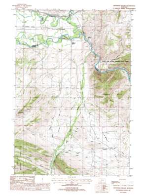
Jefferson Island Topo Map Montana
To zoom in, hover over the map of Jefferson Island
USGS Topo Quad 45111g8 - 1:24,000 scale
| Topo Map Name: | Jefferson Island |
| USGS Topo Quad ID: | 45111g8 |
| Print Size: | ca. 21 1/4" wide x 27" high |
| Southeast Coordinates: | 45.75° N latitude / 111.875° W longitude |
| Map Center Coordinates: | 45.8125° N latitude / 111.9375° W longitude |
| U.S. State: | MT |
| Filename: | o45111g8.jpg |
| Download Map JPG Image: | Jefferson Island topo map 1:24,000 scale |
| Map Type: | Topographic |
| Topo Series: | 7.5´ |
| Map Scale: | 1:24,000 |
| Source of Map Images: | United States Geological Survey (USGS) |
| Alternate Map Versions: |
Jefferson Island MT 1987, updated 1988 Download PDF Buy paper map Jefferson Island MT 1996, updated 1998 Download PDF Buy paper map Jefferson Island MT 2011 Download PDF Buy paper map Jefferson Island MT 2014 Download PDF Buy paper map |
| FStopo: | US Forest Service topo Jefferson Island is available: Download FStopo PDF Download FStopo TIF |
1:24,000 Topo Quads surrounding Jefferson Island
> Back to 45111e1 at 1:100,000 scale
> Back to 45110a1 at 1:250,000 scale
> Back to U.S. Topo Maps home
Jefferson Island topo map: Gazetteer
Jefferson Island: Basins
Shaw Basin elevation 1552m 5091′Jefferson Island: Canals
Agricultural Ditch elevation 1489m 4885′Bricker Sparrow Ditch elevation 1527m 5009′
Church Ditch elevation 1557m 5108′
Dodge Ditch elevation 1529m 5016′
Missouri Ditch elevation 1538m 5045′
North Fork Missouri Ditch elevation 1525m 5003′
Randall Ditch elevation 1429m 4688′
Rundell Ditch elevation 1536m 5039′
Three Jim Ditch elevation 1486m 4875′
Jefferson Island: Crossings
Interchange 256 elevation 1311m 4301′Jefferson Island: Mines
Highway 10 Quarry elevation 1292m 4238′La Hood Park Mine elevation 1302m 4271′
Mayflower Extension Mine elevation 1652m 5419′
NE SW Section 25 Mine elevation 1393m 4570′
NW NW Section 20 Mine elevation 1344m 4409′
Oliverson Mine elevation 1310m 4297′
Quarry Mine elevation 1323m 4340′
Jefferson Island: Parks
Father De Smet Historical Marker elevation 1321m 4333′Lewis & Clark Caverns State Park elevation 1500m 4921′
Lewis and Clark Expedition Campsite Historical Marker elevation 1321m 4333′
Jefferson Island: Populated Places
Cardwell elevation 1306m 4284′Eau Clair (historical) elevation 1302m 4271′
Jefferson Island elevation 1302m 4271′
La Hood Park elevation 1311m 4301′
Summit Valley elevation 1473m 4832′
Jefferson Island: Post Offices
Cardwell Post Office elevation 1306m 4284′Jefferson Island Post Office (historical) elevation 1302m 4271′
Lime Spur Post Office (historical) elevation 1300m 4265′
Primus Post Office (historical) elevation 1612m 5288′
Jefferson Island: Streams
Boulder River elevation 1304m 4278′Jefferson Slough elevation 1302m 4271′
Limekiln Creek elevation 1523m 4996′
South Boulder River elevation 1302m 4271′
Jefferson Island: Summits
Cave Mountain elevation 1799m 5902′London Peak elevation 1930m 6332′
Jefferson Island: Valleys
Boulder Valley elevation 1304m 4278′Pole Canyon elevation 1537m 5042′
Sheep Gulch elevation 1321m 4333′
Summit Valley elevation 1403m 4603′
Jefferson Island: Wells
01S02E17AAB_01 Well elevation 1820m 5971′02N03W33DCD_01 Well elevation 1326m 4350′
02N03W34CCD_01 Well elevation 1333m 4373′
Jefferson Island digital topo map on disk
Buy this Jefferson Island topo map showing relief, roads, GPS coordinates and other geographical features, as a high-resolution digital map file on DVD:


