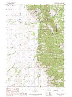
Flathead Pass Topo Map Montana
To zoom in, hover over the map of Flathead Pass
USGS Topo Quad 45111h1 - 1:24,000 scale
| Topo Map Name: | Flathead Pass |
| USGS Topo Quad ID: | 45111h1 |
| Print Size: | ca. 21 1/4" wide x 27" high |
| Southeast Coordinates: | 45.875° N latitude / 111° W longitude |
| Map Center Coordinates: | 45.9375° N latitude / 111.0625° W longitude |
| U.S. State: | MT |
| Filename: | o45111h1.jpg |
| Download Map JPG Image: | Flathead Pass topo map 1:24,000 scale |
| Map Type: | Topographic |
| Topo Series: | 7.5´ |
| Map Scale: | 1:24,000 |
| Source of Map Images: | United States Geological Survey (USGS) |
| Alternate Map Versions: |
Flathead Pass MT 1987, updated 1987 Download PDF Buy paper map Flathead Pass MT 1987, updated 1987 Download PDF Buy paper map Flathead Pass MT 2000, updated 2005 Download PDF Buy paper map Flathead Pass MT 2011 Download PDF Buy paper map Flathead Pass MT 2014 Download PDF Buy paper map |
| FStopo: | US Forest Service topo Flathead Pass is available: Download FStopo PDF Download FStopo TIF |
1:24,000 Topo Quads surrounding Flathead Pass
> Back to 45111e1 at 1:100,000 scale
> Back to 45110a1 at 1:250,000 scale
> Back to U.S. Topo Maps home
Flathead Pass topo map: Gazetteer
Flathead Pass: Gaps
Flathead Pass elevation 2083m 6833′Flathead Pass: Mines
Pass Creek Mine elevation 2204m 7230′Sept Morn Mine elevation 2248m 7375′
Flathead Pass: Populated Places
Gallop (historical) elevation 1572m 5157′Flathead Pass: Post Offices
Duncan Post Office (historical) elevation 1635m 5364′Gallop Post Office (historical) elevation 1572m 5157′
Flathead Pass: Springs
02N05E15AC__01 Spring elevation 1656m 5433′02N05E23CD__01 Spring elevation 1633m 5357′
02N05E27DD__01 Spring elevation 1516m 4973′
02N05E34AD__01 Spring elevation 1474m 4835′
Flathead Pass: Streams
Evan Reese Creek elevation 1586m 5203′Gallop Creek elevation 1550m 5085′
Tom Reese Creek elevation 1597m 5239′
Flathead Pass: Trails
Stock Drive Trail elevation 1924m 6312′Flathead Pass: Valleys
Felix Canyon elevation 1685m 5528′Grouse Canyon elevation 1734m 5688′
Johnson Canyon elevation 1754m 5754′
Mill Creek Canyon elevation 1833m 6013′
Morrison Canyon elevation 1660m 5446′
Flathead Pass: Wells
02N05E04DADD01 Well elevation 1618m 5308′02N05E10BDBD01 Well elevation 1686m 5531′
02N05E21BBCC01 Well elevation 1507m 4944′
02N05E22DDAD01 Well elevation 1611m 5285′
02N05E28CD__01 Well elevation 1473m 4832′
02N05E33BD__01 Well elevation 1426m 4678′
02N05E33CA__01 Well elevation 1411m 4629′
02N05E34DA__01 Well elevation 1456m 4776′
02N05E34DDBB01 Well elevation 1445m 4740′
02N05E34DDC_01 Well elevation 1435m 4708′
02N05E34DDD_01 Well elevation 1435m 4708′
02N05E35BA__01 Well elevation 1504m 4934′
03N05E28DD__01 Well elevation 1565m 5134′
Flathead Pass digital topo map on disk
Buy this Flathead Pass topo map showing relief, roads, GPS coordinates and other geographical features, as a high-resolution digital map file on DVD:


