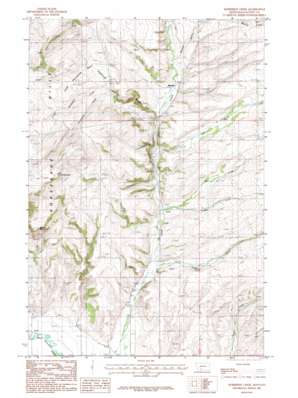
Horseshoe Creek Topo Map Montana
To zoom in, hover over the map of Horseshoe Creek
USGS Topo Quad 45111h2 - 1:24,000 scale
| Topo Map Name: | Horseshoe Creek |
| USGS Topo Quad ID: | 45111h2 |
| Print Size: | ca. 21 1/4" wide x 27" high |
| Southeast Coordinates: | 45.875° N latitude / 111.125° W longitude |
| Map Center Coordinates: | 45.9375° N latitude / 111.1875° W longitude |
| U.S. State: | MT |
| Filename: | o45111h2.jpg |
| Download Map JPG Image: | Horseshoe Creek topo map 1:24,000 scale |
| Map Type: | Topographic |
| Topo Series: | 7.5´ |
| Map Scale: | 1:24,000 |
| Source of Map Images: | United States Geological Survey (USGS) |
| Alternate Map Versions: |
Horseshoe Creek MT 1987, updated 1987 Download PDF Buy paper map Horseshoe Creek MT 2011 Download PDF Buy paper map Horseshoe Creek MT 2014 Download PDF Buy paper map |
1:24,000 Topo Quads surrounding Horseshoe Creek
> Back to 45111e1 at 1:100,000 scale
> Back to 45110a1 at 1:250,000 scale
> Back to U.S. Topo Maps home
Horseshoe Creek topo map: Gazetteer
Horseshoe Creek: Basins
Little Horseshoe Basin elevation 1549m 5082′Horseshoe Creek: Bridges
Spaulding Bridge elevation 1288m 4225′Horseshoe Creek: Populated Places
Accola elevation 1402m 4599′Edilou elevation 1316m 4317′
Hillman elevation 1327m 4353′
Menard elevation 1430m 4691′
Menard Wye elevation 1426m 4678′
Horseshoe Creek: Post Offices
Hillsdale Post Office (historical) elevation 1601m 5252′Menard Post Office (historical) elevation 1430m 4691′
Horseshoe Creek: Streams
Horseshoe Creek elevation 1489m 4885′Little Horseshoe Creek elevation 1492m 4895′
Menard Creek elevation 1445m 4740′
Mill Creek elevation 1393m 4570′
Pass Creek elevation 1432m 4698′
Quagle Creek elevation 1378m 4520′
Reynolds Creek elevation 1356m 4448′
Horseshoe Creek: Summits
Little Round Mountain elevation 1696m 5564′Round Mountain elevation 1678m 5505′
Horseshoe Creek: Valleys
Chipmunk Gulch elevation 1441m 4727′Horseshoe Creek: Wells
02N04E02DDDB01 Well elevation 1402m 4599′02N04E12CC__01 Well elevation 1428m 4685′
02N04E23DA__01 Well elevation 1358m 4455′
02N04E23DB__01 Well elevation 1399m 4589′
02N04E23DBDD01 Well elevation 1359m 4458′
02N04E24BB__01 Well elevation 1376m 4514′
02N04E24DD__01 Well elevation 1429m 4688′
02N04E26BA__01 Well elevation 1380m 4527′
02N04E26BA__02 Well elevation 1380m 4527′
02N04E28CC__01 Well elevation 1324m 4343′
02N04E29DD__01 Well elevation 1315m 4314′
02N04E33BC__01 Well elevation 1291m 4235′
02N04E33CA__01 Well elevation 1292m 4238′
02N04E35BDCC01 Well elevation 1322m 4337′
02N04E36CC__01 Well elevation 1328m 4356′
02N05E06AC__01 Well elevation 1482m 4862′
02N05E06AC__02 Well elevation 1482m 4862′
02N05E06ADDA01 Well elevation 1493m 4898′
02N05E08BC__01 Well elevation 1501m 4924′
02N05E18ABBB01 Well elevation 1460m 4790′
02N05E18BA__01 Well elevation 1463m 4799′
02N05E18BC__01 Well elevation 1440m 4724′
02N05E30BB__01 Well elevation 1423m 4668′
02N05E31DAAA01 Well elevation 1375m 4511′
02N05E31DAAA02 Well elevation 1375m 4511′
03N04E36BB__01 Well elevation 1441m 4727′
Horseshoe Creek digital topo map on disk
Buy this Horseshoe Creek topo map showing relief, roads, GPS coordinates and other geographical features, as a high-resolution digital map file on DVD:


