Beaverhead Rock Se Topo Map Montana
To zoom in, hover over the map of Beaverhead Rock Se
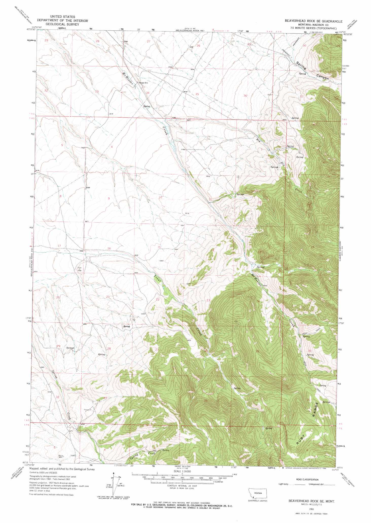
USGS Topo Quad 45112c3 - 1:24,000 scale
| Topo Map Name: | Beaverhead Rock Se |
| USGS Topo Quad ID: | 45112c3 |
| Print Size: | ca. 21 1/4" wide x 27" high |
| Southeast Coordinates: | 45.25° N latitude / 112.25° W longitude |
| Map Center Coordinates: | 45.3125° N latitude / 112.3125° W longitude |
| U.S. State: | MT |
| Filename: | o45112c3.jpg |
| Download Map JPG Image: | Beaverhead Rock Se topo map 1:24,000 scale |
| Map Type: | Topographic |
| Topo Series: | 7.5´ |
| Map Scale: | 1:24,000 |
| Source of Map Images: | United States Geological Survey (USGS) |
| Alternate Map Versions: |
Beaverhead Rock SE MT 1961, updated 1964 Download PDF Buy paper map Beaverhead Rock SE MT 2011 Download PDF Buy paper map Beaverhead Rock SE MT 2014 Download PDF Buy paper map |
1:24,000 Topo Quads surrounding Beaverhead Rock Se
Nez Perce Hollow |
Twin Bridges Sw |
Twin Bridges |
Old Baldy Mountain |
Noble Peak |
Block Mountain |
Beaverhead Rock |
Beaverhead Rock Ne |
Sheridan |
Copper Mountain |
Glen Se |
Beaverhead Rock Sw |
Beaverhead Rock Se |
Laurin Canyon |
Alder |
Dillon East |
Christensen Ranch |
Mine Gulch |
Metzel Ranch |
Ruby Dam |
Ashbough Canyon |
Elk Gulch |
Red Canyon |
Belmont Park Ranch |
Home Park Ranch |
> Back to 45112a1 at 1:100,000 scale
> Back to 45112a1 at 1:250,000 scale
> Back to U.S. Topo Maps home
Beaverhead Rock Se topo map: Gazetteer
Beaverhead Rock Se: Dams
Mad Chant Dam elevation 1711m 5613′Beaverhead Rock Se: Post Offices
McHessor Post Office (historical) elevation 1726m 5662′Beaverhead Rock Se: Streams
Big Dry Creek elevation 1693m 5554′Beaverhead Rock Se: Valleys
Spring Canyon elevation 1732m 5682′Beaverhead Rock Se digital topo map on disk
Buy this Beaverhead Rock Se topo map showing relief, roads, GPS coordinates and other geographical features, as a high-resolution digital map file on DVD: