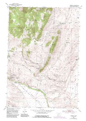
Argenta Topo Map Montana
To zoom in, hover over the map of Argenta
USGS Topo Quad 45112c7 - 1:24,000 scale
| Topo Map Name: | Argenta |
| USGS Topo Quad ID: | 45112c7 |
| Print Size: | ca. 21 1/4" wide x 27" high |
| Southeast Coordinates: | 45.25° N latitude / 112.75° W longitude |
| Map Center Coordinates: | 45.3125° N latitude / 112.8125° W longitude |
| U.S. State: | MT |
| Filename: | o45112c7.jpg |
| Download Map JPG Image: | Argenta topo map 1:24,000 scale |
| Map Type: | Topographic |
| Topo Series: | 7.5´ |
| Map Scale: | 1:24,000 |
| Source of Map Images: | United States Geological Survey (USGS) |
| Alternate Map Versions: |
Argenta MT 1952, updated 1954 Download PDF Buy paper map Argenta MT 1952, updated 1969 Download PDF Buy paper map Argenta MT 1952, updated 1979 Download PDF Buy paper map Argenta MT 1952, updated 1982 Download PDF Buy paper map Argenta MT 1952, updated 1989 Download PDF Buy paper map Argenta MT 1997, updated 2002 Download PDF Buy paper map Argenta MT 2011 Download PDF Buy paper map Argenta MT 2014 Download PDF Buy paper map |
| FStopo: | US Forest Service topo Argenta is available: Download FStopo PDF Download FStopo TIF |
1:24,000 Topo Quads surrounding Argenta
> Back to 45112a1 at 1:100,000 scale
> Back to 45112a1 at 1:250,000 scale
> Back to U.S. Topo Maps home
Argenta topo map: Gazetteer
Argenta: Flats
Argenta Flats elevation 1784m 5853′Argenta: Mines
Albers Spring Mine elevation 1908m 6259′Amaranth/Robert Burns Mine elevation 1935m 6348′
Anaconda Mine elevation 1971m 6466′
Brownell Mine elevation 1985m 6512′
Capitol Mine elevation 2342m 7683′
Dexter Gulch Mine elevation 2046m 6712′
Dexter Mine elevation 2091m 6860′
Dexter Mine elevation 2095m 6873′
Dutchman Mountain Mine elevation 1932m 6338′
Ferdinand Mine elevation 1873m 6145′
Ferdinand Mine elevation 1865m 6118′
Frying Pan Basin Mine elevation 1711m 5613′
Galena Mine elevation 2025m 6643′
Good Friday Gulch Mine elevation 1976m 6482′
Govtilden Mine elevation 2106m 6909′
Iron Mountain Mine elevation 1939m 6361′
Jack Rabbit Mine elevation 1926m 6318′
Long John Gulch Mine elevation 2214m 7263′
Mauldin Mine elevation 1980m 6496′
NW Section 29 Mine elevation 1946m 6384′
Rosemont Mine elevation 2047m 6715′
SW Section 8 Mine elevation 2103m 6899′
Tuscarora Mine elevation 2087m 6847′
White Lime Mine elevation 2027m 6650′
Argenta: Populated Places
Argenta elevation 1871m 6138′Argenta: Post Offices
Argenta Post Office (historical) elevation 1871m 6138′Argenta: Springs
Albers Spring elevation 1866m 6122′Argenta Spring elevation 2099m 6886′
Cave Gulch Spring elevation 2314m 7591′
Cedar Spring elevation 1702m 5583′
Dutchman Spring elevation 1821m 5974′
Frying Pan Spring elevation 1724m 5656′
Kennison Spring elevation 1820m 5971′
Argenta: Summits
Canyon Mountain elevation 2272m 7454′Dutchman Mountain elevation 2228m 7309′
Humbolt Mountain elevation 2805m 9202′
Quartz Hill elevation 2039m 6689′
Argenta: Valleys
Dexter Gulch elevation 1865m 6118′Good Friday Gulch elevation 1866m 6122′
Long John Gulch elevation 1889m 6197′
Spring Gulch elevation 1779m 5836′
Van Dyke Gulch elevation 1822m 5977′
Argenta: Wells
05S10W36DDCC01 Well elevation 1847m 6059′06S10W29DDCD01 Well elevation 1849m 6066′
Argenta digital topo map on disk
Buy this Argenta topo map showing relief, roads, GPS coordinates and other geographical features, as a high-resolution digital map file on DVD:


