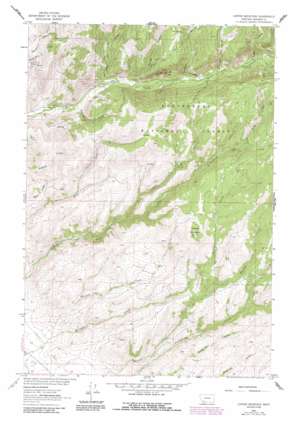
Copper Mountain Topo Map Montana
To zoom in, hover over the map of Copper Mountain
USGS Topo Quad 45112d1 - 1:24,000 scale
| Topo Map Name: | Copper Mountain |
| USGS Topo Quad ID: | 45112d1 |
| Print Size: | ca. 21 1/4" wide x 27" high |
| Southeast Coordinates: | 45.375° N latitude / 112° W longitude |
| Map Center Coordinates: | 45.4375° N latitude / 112.0625° W longitude |
| U.S. State: | MT |
| Filename: | o45112d1.jpg |
| Download Map JPG Image: | Copper Mountain topo map 1:24,000 scale |
| Map Type: | Topographic |
| Topo Series: | 7.5´ |
| Map Scale: | 1:24,000 |
| Source of Map Images: | United States Geological Survey (USGS) |
| Alternate Map Versions: |
Copper Mountain MT 1963, updated 1964 Download PDF Buy paper map Copper Mountain MT 1963, updated 1989 Download PDF Buy paper map Copper Mountain MT 1997, updated 2002 Download PDF Buy paper map Copper Mountain MT 2011 Download PDF Buy paper map Copper Mountain MT 2014 Download PDF Buy paper map |
| FStopo: | US Forest Service topo Copper Mountain is available: Download FStopo PDF Download FStopo TIF |
1:24,000 Topo Quads surrounding Copper Mountain
> Back to 45112a1 at 1:100,000 scale
> Back to 45112a1 at 1:250,000 scale
> Back to U.S. Topo Maps home
Copper Mountain topo map: Gazetteer
Copper Mountain: Mines
Agitator/Concentrator Mine elevation 1942m 6371′Betsy Baker Mine elevation 2158m 7080′
Copper Mountain Mine elevation 2174m 7132′
Freida Mine elevation 1914m 6279′
Goldschmidt-Steiner Mine elevation 2123m 6965′
Grandview Mine elevation 1807m 5928′
Harris Creek Talc Mine elevation 1813m 5948′
Horse Creek Quartz Mine elevation 1836m 6023′
Hunts Claim Mine elevation 1956m 6417′
J and J Mine elevation 2062m 6765′
Jane and Nash Mine elevation 1874m 6148′
Latest Out Mine elevation 1898m 6227′
Nash Group Mine elevation 1944m 6377′
NE NE Section 20 Mine elevation 1901m 6236′
NE SW Section 30 Mine elevation 2126m 6975′
North Fork Antelope Creek Mine elevation 2042m 6699′
NW NE Section 30 Mine elevation 2311m 7582′
Paymaster Mine elevation 2343m 7687′
Paymaster Mine elevation 2274m 7460′
Pedro Mine elevation 2695m 8841′
Pot Rustler Mine elevation 2292m 7519′
Sage Hen Mine elevation 1840m 6036′
Sandstrom Mine elevation 2162m 7093′
SE NW Section 36 Mine elevation 2160m 7086′
SE SE Section 11 Mine elevation 2006m 6581′
Silver Bar Mine elevation 2268m 7440′
Silver Bullion Mine elevation 2159m 7083′
Smuggler Mine elevation 2193m 7194′
Smuggler Mine elevation 2154m 7066′
SW NW Section 7 Mine elevation 2047m 6715′
SW SW Section 12 Mine elevation 2413m 7916′
Toledo Mine elevation 1994m 6541′
Toledo Mine elevation 1975m 6479′
Upper Pot Rustler Mine elevation 2353m 7719′
Wrights Mine elevation 2020m 6627′
Copper Mountain: Parks
Non Pareil Park elevation 2320m 7611′Copper Mountain: Streams
Cow Creek elevation 1930m 6332′Currant Creek elevation 1805m 5921′
East Fork Quartz Creek elevation 2400m 7874′
Eclipse Creek elevation 1783m 5849′
Johnson Creek elevation 2149m 7050′
Leggat Creek elevation 2249m 7378′
North Fork Ramshorn Creek elevation 2165m 7103′
Peacock Creek elevation 1791m 5875′
Quartz Creek elevation 2064m 6771′
South Fork Mill Creek elevation 2285m 7496′
Stonewall Creek elevation 2079m 6820′
Studhorse Creek elevation 2023m 6637′
Wakefield Creek elevation 1640m 5380′
Copper Mountain: Summits
Copper Mountain elevation 2223m 7293′Copper Mountain: Trails
Cow Creek Trail elevation 2124m 6968′Currant Creek Trail elevation 2252m 7388′
Peacock Creek Trail elevation 2194m 7198′
Pedro Trail elevation 2411m 7910′
Quartz Hill Trail elevation 2356m 7729′
Copper Mountain: Valleys
Bridge Canyon elevation 2009m 6591′Cherry Gulch elevation 1596m 5236′
Donegan Gulch elevation 1798m 5898′
Kings Gulch elevation 2068m 6784′
Reese Gulch elevation 1725m 5659′
Copper Mountain: Wells
05S04W28BBAB01 Well elevation 1573m 5160′05S04W28BBAB02 Well elevation 1573m 5160′
Copper Mountain digital topo map on disk
Buy this Copper Mountain topo map showing relief, roads, GPS coordinates and other geographical features, as a high-resolution digital map file on DVD:


