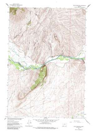
Block Mountain Topo Map Montana
To zoom in, hover over the map of Block Mountain
USGS Topo Quad 45112d5 - 1:24,000 scale
| Topo Map Name: | Block Mountain |
| USGS Topo Quad ID: | 45112d5 |
| Print Size: | ca. 21 1/4" wide x 27" high |
| Southeast Coordinates: | 45.375° N latitude / 112.5° W longitude |
| Map Center Coordinates: | 45.4375° N latitude / 112.5625° W longitude |
| U.S. State: | MT |
| Filename: | o45112d5.jpg |
| Download Map JPG Image: | Block Mountain topo map 1:24,000 scale |
| Map Type: | Topographic |
| Topo Series: | 7.5´ |
| Map Scale: | 1:24,000 |
| Source of Map Images: | United States Geological Survey (USGS) |
| Alternate Map Versions: |
Block Mountain MT 1960, updated 1963 Download PDF Buy paper map Block Mountain MT 1960, updated 1975 Download PDF Buy paper map Block Mountain MT 1960, updated 1986 Download PDF Buy paper map Block Mountain MT 1960, updated 1986 Download PDF Buy paper map Block Mountain MT 2011 Download PDF Buy paper map Block Mountain MT 2014 Download PDF Buy paper map |
1:24,000 Topo Quads surrounding Block Mountain
> Back to 45112a1 at 1:100,000 scale
> Back to 45112a1 at 1:250,000 scale
> Back to U.S. Topo Maps home
Block Mountain topo map: Gazetteer
Block Mountain: Canals
Buhrer-Garrison Ditch elevation 1505m 4937′Cocanougher Ditch elevation 1470m 4822′
Fred Bryant Ditch elevation 1480m 4855′
Block Mountain: Cliffs
Buffalo Jump elevation 1500m 4921′Block Mountain: Mines
Sodak Mine elevation 1664m 5459′Sodak Mine elevation 1667m 5469′
Block Mountain: Populated Places
Sodak Mill elevation 1502m 4927′Block Mountain: Ridges
Hogback elevation 1728m 5669′Block Mountain: Springs
Box Spring elevation 1739m 5705′Garrison Spring elevation 1948m 6391′
Mill Spring elevation 1857m 6092′
Block Mountain: Streams
Stevens Slough elevation 1481m 4858′Block Mountain: Summits
Bell Peak elevation 2397m 7864′Block Mountain elevation 1823m 5980′
Block Mountain: Valleys
Buhrer Gulch elevation 1517m 4977′Chokecherry Gulch elevation 1520m 4986′
Creasey Gulch elevation 1505m 4937′
Reservoir Gulch elevation 1690m 5544′
Sandy Hollow elevation 1490m 4888′
Ziegler Gulch elevation 1505m 4937′
Block Mountain: Wells
04S07W32CBCB01 Well elevation 1470m 4822′Block Mountain digital topo map on disk
Buy this Block Mountain topo map showing relief, roads, GPS coordinates and other geographical features, as a high-resolution digital map file on DVD:


