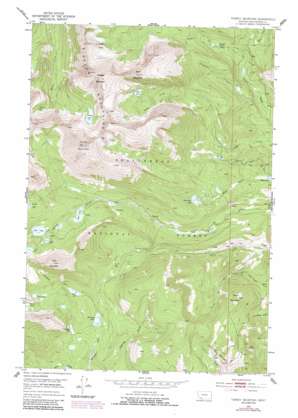
Torrey Mountain Topo Map Montana
To zoom in, hover over the map of Torrey Mountain
USGS Topo Quad 45112d8 - 1:24,000 scale
| Topo Map Name: | Torrey Mountain |
| USGS Topo Quad ID: | 45112d8 |
| Print Size: | ca. 21 1/4" wide x 27" high |
| Southeast Coordinates: | 45.375° N latitude / 112.875° W longitude |
| Map Center Coordinates: | 45.4375° N latitude / 112.9375° W longitude |
| U.S. State: | MT |
| Filename: | o45112d8.jpg |
| Download Map JPG Image: | Torrey Mountain topo map 1:24,000 scale |
| Map Type: | Topographic |
| Topo Series: | 7.5´ |
| Map Scale: | 1:24,000 |
| Source of Map Images: | United States Geological Survey (USGS) |
| Alternate Map Versions: |
Torrey Mountain MT 1952, updated 1954 Download PDF Buy paper map Torrey Mountain MT 1952, updated 1971 Download PDF Buy paper map Torrey Mountain MT 1952, updated 1977 Download PDF Buy paper map Torrey Mountain MT 1952, updated 1989 Download PDF Buy paper map Torrey Mountain MT 1952, updated 1989 Download PDF Buy paper map Torrey Mountain MT 1997, updated 2002 Download PDF Buy paper map Torrey Mountain MT 2011 Download PDF Buy paper map Torrey Mountain MT 2014 Download PDF Buy paper map |
| FStopo: | US Forest Service topo Torrey Mountain is available: Download FStopo PDF Download FStopo TIF |
1:24,000 Topo Quads surrounding Torrey Mountain
> Back to 45112a1 at 1:100,000 scale
> Back to 45112a1 at 1:250,000 scale
> Back to U.S. Topo Maps home
Torrey Mountain topo map: Gazetteer
Torrey Mountain: Canals
Mast Ditch elevation 2217m 7273′Torrey Mountain: Dams
Anchor Lake North Dam elevation 2791m 9156′Anchor South Dam elevation 2790m 9153′
Boot Lake Dam elevation 2514m 8248′
Dearhead Lake Dam elevation 2348m 7703′
Pear Lake Dam elevation 2647m 8684′
Tub Lake Dam elevation 2774m 9101′
Torrey Mountain: Lakes
Barb Lake elevation 2801m 9189′Boatman Lake elevation 2496m 8188′
Deerhead Lake elevation 2313m 7588′
Glacier Lake elevation 2689m 8822′
Gorge Lakes elevation 2799m 9183′
Lily Lake elevation 2399m 7870′
May Lake elevation 2655m 8710′
Minneopa Lake elevation 2493m 8179′
Pear Lake elevation 2647m 8684′
Tent Lake elevation 2556m 8385′
Torrey Lake elevation 2734m 8969′
Twin Lakes elevation 2706m 8877′
Torrey Mountain: Mines
Humbolt Mountain Mine elevation 2589m 8494′Indian Squaw Mine elevation 2698m 8851′
US Treasurer Mine elevation 2684m 8805′
Torrey Mountain: Ranges
Pioneer Mountains elevation 3068m 10065′Torrey Mountain: Reservoirs
Anchor Lake elevation 2790m 9153′Anchor Lake elevation 2791m 9156′
Bond Lake elevation 2178m 7145′
Boot Lake elevation 2513m 8244′
Deerhead Lake elevation 2348m 7703′
Pear Lake elevation 2647m 8684′
Tub Lake elevation 2772m 9094′
Torrey Mountain: Streams
Buckhorn Creek elevation 2075m 6807′Estler Creek elevation 2399m 7870′
Gorge Creek elevation 2183m 7162′
Mule Creek elevation 2230m 7316′
South Fork Thief Creek elevation 2062m 6765′
Uphill Creek elevation 2271m 7450′
Torrey Mountain: Summits
Barb Mountain elevation 3190m 10465′Tent Mountain elevation 3104m 10183′
Torrey Mountain elevation 3392m 11128′
Tower Mountain elevation 2826m 9271′
Tweedy Mountain elevation 3394m 11135′
Torrey Mountain digital topo map on disk
Buy this Torrey Mountain topo map showing relief, roads, GPS coordinates and other geographical features, as a high-resolution digital map file on DVD:


