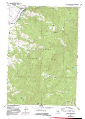
Foolhen Mountain Topo Map Montana
To zoom in, hover over the map of Foolhen Mountain
USGS Topo Quad 45113g2 - 1:24,000 scale
| Topo Map Name: | Foolhen Mountain |
| USGS Topo Quad ID: | 45113g2 |
| Print Size: | ca. 21 1/4" wide x 27" high |
| Southeast Coordinates: | 45.75° N latitude / 113.125° W longitude |
| Map Center Coordinates: | 45.8125° N latitude / 113.1875° W longitude |
| U.S. State: | MT |
| Filename: | o45113g2.jpg |
| Download Map JPG Image: | Foolhen Mountain topo map 1:24,000 scale |
| Map Type: | Topographic |
| Topo Series: | 7.5´ |
| Map Scale: | 1:24,000 |
| Source of Map Images: | United States Geological Survey (USGS) |
| Alternate Map Versions: |
Foolhen Mountain MT 1962, updated 1964 Download PDF Buy paper map Foolhen Mountain MT 1962, updated 1989 Download PDF Buy paper map Foolhen Mountain MT 1962, updated 1994 Download PDF Buy paper map Foolhen Mountain MT 1997, updated 2002 Download PDF Buy paper map Foolhen Mountain MT 2011 Download PDF Buy paper map Foolhen Mountain MT 2014 Download PDF Buy paper map |
| FStopo: | US Forest Service topo Foolhen Mountain is available: Download FStopo PDF Download FStopo TIF |
1:24,000 Topo Quads surrounding Foolhen Mountain
> Back to 45113e1 at 1:100,000 scale
> Back to 45112a1 at 1:250,000 scale
> Back to U.S. Topo Maps home
Foolhen Mountain topo map: Gazetteer
Foolhen Mountain: Flats
Moose Park elevation 2078m 6817′Foolhen Mountain: Lakes
Ferguson Lake elevation 2296m 7532′Johanna Lake elevation 2471m 8106′
Lovell Lake elevation 2131m 6991′
Foolhen Mountain: Mines
Calvert Mine elevation 2126m 6975′Foolhen Mountain: Populated Places
Fishtrap elevation 1791m 5875′Foolhen Mountain: Post Offices
Fishtrap Post Office (historical) elevation 1791m 5875′Foolhen Mountain: Ridges
Foolhen Ridge elevation 2455m 8054′Foolhen Mountain: Springs
Zero Spring elevation 2118m 6948′Foolhen Mountain: Streams
Calvert Creek elevation 1787m 5862′Calvert Creek elevation 1932m 6338′
Fishtrap Creek elevation 1780m 5839′
La Marche Creek elevation 1772m 5813′
Minnie Creek elevation 1779m 5836′
Tucker Creek elevation 1787m 5862′
Walker Creek elevation 1781m 5843′
Foolhen Mountain: Summits
Calvert Hill elevation 2369m 7772′Foolhen Mountain elevation 2770m 9087′
Trident Peak elevation 2429m 7969′
Foolhen Mountain: Swamps
Trident Meadows elevation 2289m 7509′Foolhen Mountain: Wells
01N13W04BCBC01 Well elevation 1798m 5898′Foolhen Mountain digital topo map on disk
Buy this Foolhen Mountain topo map showing relief, roads, GPS coordinates and other geographical features, as a high-resolution digital map file on DVD:


