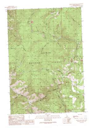
Jureano Mountain Topo Map Idaho
To zoom in, hover over the map of Jureano Mountain
USGS Topo Quad 45114b2 - 1:24,000 scale
| Topo Map Name: | Jureano Mountain |
| USGS Topo Quad ID: | 45114b2 |
| Print Size: | ca. 21 1/4" wide x 27" high |
| Southeast Coordinates: | 45.125° N latitude / 114.125° W longitude |
| Map Center Coordinates: | 45.1875° N latitude / 114.1875° W longitude |
| U.S. State: | ID |
| Filename: | o45114b2.jpg |
| Download Map JPG Image: | Jureano Mountain topo map 1:24,000 scale |
| Map Type: | Topographic |
| Topo Series: | 7.5´ |
| Map Scale: | 1:24,000 |
| Source of Map Images: | United States Geological Survey (USGS) |
| Alternate Map Versions: |
Jureano Mountain ID 1989, updated 1989 Download PDF Buy paper map Jureano Mountain ID 2011 Download PDF Buy paper map Jureano Mountain ID 2013 Download PDF Buy paper map |
| FStopo: | US Forest Service topo Jureano Mountain is available: Download FStopo PDF Download FStopo TIF |
1:24,000 Topo Quads surrounding Jureano Mountain
> Back to 45114a1 at 1:100,000 scale
> Back to 45114a1 at 1:250,000 scale
> Back to U.S. Topo Maps home
Jureano Mountain topo map: Gazetteer
Jureano Mountain: Bars
California Bar elevation 1909m 6263′Jureano Mountain: Basins
White Horse Basin elevation 1941m 6368′Jureano Mountain: Falls
Napias Creek Falls elevation 1556m 5104′Jureano Mountain: Mines
Haidee Mine elevation 2253m 7391′Italian Mine elevation 2109m 6919′
Jureano Placer Diggings elevation 2132m 6994′
Ringbone Cayuse Mine elevation 2031m 6663′
Jureano Mountain: Ridges
Leacock Point elevation 2191m 7188′Jureano Mountain: Streams
Arnett Creek elevation 1968m 6456′Cat Creek elevation 1889m 6197′
Cliff Creek elevation 1496m 4908′
Deep Creek elevation 1489m 4885′
Mackinaw Creek elevation 1814m 5951′
Moccasin Creek elevation 1750m 5741′
Napias Creek elevation 1471m 4826′
Phelan Creek elevation 1848m 6062′
Pony Creek elevation 1913m 6276′
Rabbit Creek elevation 1924m 6312′
Rapps Creek elevation 2005m 6578′
South Fork Phelan Creek elevation 1964m 6443′
Jureano Mountain: Summits
Jureano Mountain elevation 2543m 8343′Jureano Mountain: Valleys
China Gulch elevation 2022m 6633′Davis Gulch elevation 2112m 6929′
Gold Bug Gulch elevation 2049m 6722′
Missouri Gulch elevation 1865m 6118′
Quartz Gulch elevation 1491m 4891′
Jureano Mountain digital topo map on disk
Buy this Jureano Mountain topo map showing relief, roads, GPS coordinates and other geographical features, as a high-resolution digital map file on DVD:


