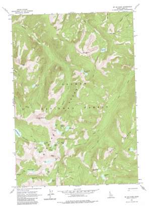
Mount Mcguire Topo Map Idaho
To zoom in, hover over the map of Mount Mcguire
USGS Topo Quad 45114b5 - 1:24,000 scale
| Topo Map Name: | Mount Mcguire |
| USGS Topo Quad ID: | 45114b5 |
| Print Size: | ca. 21 1/4" wide x 27" high |
| Southeast Coordinates: | 45.125° N latitude / 114.5° W longitude |
| Map Center Coordinates: | 45.1875° N latitude / 114.5625° W longitude |
| U.S. State: | ID |
| Filename: | o45114b5.jpg |
| Download Map JPG Image: | Mount Mcguire topo map 1:24,000 scale |
| Map Type: | Topographic |
| Topo Series: | 7.5´ |
| Map Scale: | 1:24,000 |
| Source of Map Images: | United States Geological Survey (USGS) |
| Alternate Map Versions: |
Mt Mc Guire ID 1962, updated 1964 Download PDF Buy paper map Mt Mc Guire ID 1962, updated 1975 Download PDF Buy paper map Mt Mc Guire ID 1962, updated 1984 Download PDF Buy paper map Mount McGuire ID 2011 Download PDF Buy paper map Mount McGuire ID 2013 Download PDF Buy paper map |
| FStopo: | US Forest Service topo Mount McGuire is available: Download FStopo PDF Download FStopo TIF |
1:24,000 Topo Quads surrounding Mount Mcguire
> Back to 45114a1 at 1:100,000 scale
> Back to 45114a1 at 1:250,000 scale
> Back to U.S. Topo Maps home
Mount Mcguire topo map: Gazetteer
Mount Mcguire: Lakes
Airplane Lake elevation 2562m 8405′Barking Fox Lake elevation 2544m 8346′
Big Clear Lake elevation 2611m 8566′
Birdbill Lake elevation 2644m 8674′
Cathedral Lake elevation 2526m 8287′
Crater Lake elevation 2655m 8710′
Deer Lake elevation 2541m 8336′
Gentian Lake elevation 2632m 8635′
Glacier Lake elevation 2726m 8943′
Goat Lake elevation 2436m 7992′
Gooseneck Lake elevation 2667m 8750′
Harbor Lake elevation 2721m 8927′
Heart Lake elevation 2632m 8635′
Mirrow Lake elevation 2494m 8182′
Parrott Lake elevation 2496m 8188′
Pollywog Lake elevation 2533m 8310′
Pothole Lake elevation 2642m 8667′
Roaring Creek Lakes elevation 2484m 8149′
Sheepeater Lake elevation 2645m 8677′
Ship Island Lake elevation 2390m 7841′
Shoban Lake elevation 2633m 8638′
Terrace Lakes elevation 2580m 8464′
Welcome Lake elevation 2541m 8336′
Wilson Lake elevation 2715m 8907′
Mount Mcguire: Ranges
Bighorn Crags elevation 2939m 9642′Mount Mcguire: Ridges
Fishfin Ridge elevation 2868m 9409′Fishing Ridge elevation 2567m 8421′
Mount Mcguire: Streams
Parrott Creek elevation 2564m 8412′Mount Mcguire: Summits
Beehive elevation 2922m 9586′Cathedral Rock elevation 2865m 9399′
Dome Mountain elevation 2834m 9297′
Goat Mountain elevation 2929m 9609′
Mount McGuire elevation 3075m 10088′
Mount Mcguire: Trails
Clear Creek Trail elevation 2337m 7667′Crags Trail elevation 2821m 9255′
Gant Ridge Trail elevation 2638m 8654′
Ship Island Trail elevation 2537m 8323′
Waterfall Trail elevation 2497m 8192′
Mount Mcguire digital topo map on disk
Buy this Mount Mcguire topo map showing relief, roads, GPS coordinates and other geographical features, as a high-resolution digital map file on DVD:


