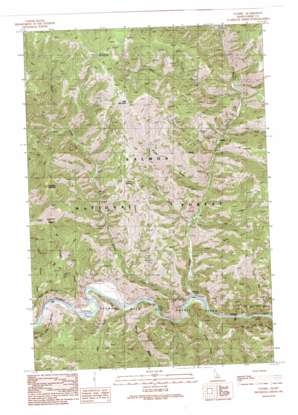
Ulysses Topo Map Idaho
To zoom in, hover over the map of Ulysses
USGS Topo Quad 45114d2 - 1:24,000 scale
| Topo Map Name: | Ulysses |
| USGS Topo Quad ID: | 45114d2 |
| Print Size: | ca. 21 1/4" wide x 27" high |
| Southeast Coordinates: | 45.375° N latitude / 114.125° W longitude |
| Map Center Coordinates: | 45.4375° N latitude / 114.1875° W longitude |
| U.S. State: | ID |
| Filename: | o45114d2.jpg |
| Download Map JPG Image: | Ulysses topo map 1:24,000 scale |
| Map Type: | Topographic |
| Topo Series: | 7.5´ |
| Map Scale: | 1:24,000 |
| Source of Map Images: | United States Geological Survey (USGS) |
| Alternate Map Versions: |
Ulysses ID 1991, updated 1991 Download PDF Buy paper map Ulysses ID 2011 Download PDF Buy paper map Ulysses ID 2013 Download PDF Buy paper map |
| FStopo: | US Forest Service topo Ulysses is available: Download FStopo PDF Download FStopo TIF |
1:24,000 Topo Quads surrounding Ulysses
> Back to 45114a1 at 1:100,000 scale
> Back to 45114a1 at 1:250,000 scale
> Back to U.S. Topo Maps home
Ulysses topo map: Gazetteer
Ulysses: Basins
Dutchler Basin elevation 1659m 5442′Ulysses: Mines
Kitty Burton Mine elevation 1588m 5209′Ulysses Mine elevation 1545m 5068′
Ulysses: Populated Places
Ulysses (historical) elevation 1271m 4169′Ulysses: Springs
Coyote Spring elevation 1802m 5912′Porcupine Spring elevation 2346m 7696′
Ulysses: Streams
Cabin Creek elevation 1166m 3825′Corral Creek elevation 1442m 4730′
East Boulder Creek elevation 1061m 3480′
East Fork Indian Creek elevation 1274m 4179′
Indian Creek elevation 1081m 3546′
Little Sage Creek elevation 1083m 3553′
Little Spring Creek elevation 1054m 3458′
Papoose Creek elevation 1192m 3910′
Squaw Creek elevation 1059m 3474′
West Fork Indian Creek elevation 1360m 4461′
West Fork Squaw Creek elevation 1560m 5118′
Ulysses: Summits
Bald Mountain elevation 2322m 7618′Dutchler Mountain elevation 2146m 7040′
Ulysses: Valleys
Brushy Gulch elevation 1248m 4094′Cow Gulch elevation 1184m 3884′
Crystal Gulch elevation 1112m 3648′
Hale Gulch elevation 1045m 3428′
Kitty Gulch elevation 1292m 4238′
Sawlog Gulch elevation 1058m 3471′
Transfer Gulch elevation 1048m 3438′
Ulysses digital topo map on disk
Buy this Ulysses topo map showing relief, roads, GPS coordinates and other geographical features, as a high-resolution digital map file on DVD:


