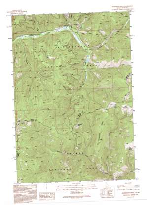
Henderson Ridge Topo Map Montana
To zoom in, hover over the map of Henderson Ridge
USGS Topo Quad 45114e2 - 1:24,000 scale
| Topo Map Name: | Henderson Ridge |
| USGS Topo Quad ID: | 45114e2 |
| Print Size: | ca. 21 1/4" wide x 27" high |
| Southeast Coordinates: | 45.5° N latitude / 114.125° W longitude |
| Map Center Coordinates: | 45.5625° N latitude / 114.1875° W longitude |
| U.S. States: | MT, ID |
| Filename: | o45114e2.jpg |
| Download Map JPG Image: | Henderson Ridge topo map 1:24,000 scale |
| Map Type: | Topographic |
| Topo Series: | 7.5´ |
| Map Scale: | 1:24,000 |
| Source of Map Images: | United States Geological Survey (USGS) |
| Alternate Map Versions: |
Henderson Ridge ID 1991, updated 1991 Download PDF Buy paper map Henderson Ridge ID 1991, updated 1995 Download PDF Buy paper map Henderson Ridge ID 1998, updated 2002 Download PDF Buy paper map Henderson Ridge ID 2011 Download PDF Buy paper map Henderson Ridge ID 2013 Download PDF Buy paper map |
| FStopo: | US Forest Service topo Henderson Ridge is available: Download FStopo PDF Download FStopo TIF |
1:24,000 Topo Quads surrounding Henderson Ridge
> Back to 45114e1 at 1:100,000 scale
> Back to 45114a1 at 1:250,000 scale
> Back to U.S. Topo Maps home
Henderson Ridge topo map: Gazetteer
Henderson Ridge: Mines
Hughes Creek Placer Mine elevation 1896m 6220′Taylor Creek Mine elevation 1798m 5898′
Taylor Creek Mine elevation 1829m 6000′
Henderson Ridge: Ridges
Henderson Ridge elevation 2100m 6889′Henderson Ridge: Springs
Bare Spring elevation 2394m 7854′Grizzly Spring elevation 2350m 7709′
Muleshoe Springs elevation 2441m 8008′
Tincan Spring elevation 2310m 7578′
Henderson Ridge: Streams
Burrell Creek elevation 1780m 5839′Chrandal Creek elevation 1598m 5242′
Christmas Tree Creek elevation 1592m 5223′
McConn Creek elevation 1440m 4724′
Mine Creek elevation 1701m 5580′
Spruce Creek elevation 1623m 5324′
Taylor Creek elevation 1670m 5479′
Henderson Ridge: Summits
Irishmans Rock elevation 2295m 7529′Henderson Ridge: Valleys
Kraft Gulch elevation 1803m 5915′Meadow Gulch elevation 1663m 5456′
Mill Gulch elevation 1658m 5439′
Robb Gulch elevation 1699m 5574′
Henderson Ridge digital topo map on disk
Buy this Henderson Ridge topo map showing relief, roads, GPS coordinates and other geographical features, as a high-resolution digital map file on DVD:


