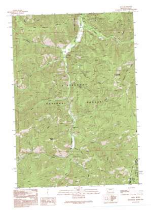
Alta Topo Map Montana
To zoom in, hover over the map of Alta
USGS Topo Quad 45114e3 - 1:24,000 scale
| Topo Map Name: | Alta |
| USGS Topo Quad ID: | 45114e3 |
| Print Size: | ca. 21 1/4" wide x 27" high |
| Southeast Coordinates: | 45.5° N latitude / 114.25° W longitude |
| Map Center Coordinates: | 45.5625° N latitude / 114.3125° W longitude |
| U.S. States: | MT, ID |
| Filename: | o45114e3.jpg |
| Download Map JPG Image: | Alta topo map 1:24,000 scale |
| Map Type: | Topographic |
| Topo Series: | 7.5´ |
| Map Scale: | 1:24,000 |
| Source of Map Images: | United States Geological Survey (USGS) |
| Alternate Map Versions: |
Alta MT 1991, updated 1991 Download PDF Buy paper map Alta MT 1991, updated 1995 Download PDF Buy paper map Alta MT 1998, updated 2002 Download PDF Buy paper map Alta MT 2011 Download PDF Buy paper map Alta MT 2014 Download PDF Buy paper map |
| FStopo: | US Forest Service topo Alta is available: Download FStopo PDF Download FStopo TIF |
1:24,000 Topo Quads surrounding Alta
> Back to 45114e1 at 1:100,000 scale
> Back to 45114a1 at 1:250,000 scale
> Back to U.S. Topo Maps home
Alta topo map: Gazetteer
Alta: Mines
Copper Queen Mine elevation 1692m 5551′Copper Queen Mine elevation 1680m 5511′
Lucky Joe Mine elevation 1590m 5216′
Lucky Joe Mine elevation 1710m 5610′
NE NE Section 20 Mine elevation 1674m 5492′
NW NW Section 21 Mine elevation 1836m 6023′
SE SW Section 3 Mine elevation 1875m 6151′
Sheep Creek Columbite Mine elevation 1741m 5711′
SW NW Section 21 Mine elevation 1662m 5452′
SW SE Section 21 Mine elevation 1626m 5334′
Alta: Populated Places
Alta elevation 1520m 4986′Alta: Post Offices
Alta Post Office (historical) elevation 1520m 4986′Alta: Ridges
Than Wilkerson Ridge elevation 1934m 6345′Alta: Springs
Marlin Spring elevation 2377m 7798′Saddle Spring elevation 2380m 7808′
Alta: Streams
Beaver Creek elevation 1688m 5538′Castner Creek elevation 1691m 5547′
Chicken Creek elevation 1532m 5026′
Deer Creek elevation 1543m 5062′
Devil Creek elevation 1639m 5377′
Hughes Creek elevation 1511m 4957′
Johnson Creek elevation 1652m 5419′
Salt Block Creek elevation 1577m 5173′
Salt Creek elevation 1629m 5344′
Sheep Creek elevation 1720m 5643′
Solider Creek elevation 2250m 7381′
Thunder Creek elevation 1572m 5157′
Woods Creek elevation 1594m 5229′
Alta: Summits
Beaver Point elevation 2256m 7401′Thunder Mountain elevation 2298m 7539′
Alta: Valleys
Cooper Draw elevation 1745m 5725′Malloy Gulch elevation 1579m 5180′
Alta digital topo map on disk
Buy this Alta topo map showing relief, roads, GPS coordinates and other geographical features, as a high-resolution digital map file on DVD:


