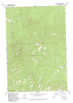
Dennis Mountain Topo Map Idaho
To zoom in, hover over the map of Dennis Mountain
USGS Topo Quad 45114e8 - 1:24,000 scale
| Topo Map Name: | Dennis Mountain |
| USGS Topo Quad ID: | 45114e8 |
| Print Size: | ca. 21 1/4" wide x 27" high |
| Southeast Coordinates: | 45.5° N latitude / 114.875° W longitude |
| Map Center Coordinates: | 45.5625° N latitude / 114.9375° W longitude |
| U.S. State: | ID |
| Filename: | o45114e8.jpg |
| Download Map JPG Image: | Dennis Mountain topo map 1:24,000 scale |
| Map Type: | Topographic |
| Topo Series: | 7.5´ |
| Map Scale: | 1:24,000 |
| Source of Map Images: | United States Geological Survey (USGS) |
| Alternate Map Versions: |
Dennis Mtn ID 1978, updated 1978 Download PDF Buy paper map Dennis Mtn ID 1991, updated 1994 Download PDF Buy paper map Dennis Mountain ID 1998, updated 2002 Download PDF Buy paper map Dennis Mountain ID 2011 Download PDF Buy paper map Dennis Mountain ID 2013 Download PDF Buy paper map |
| FStopo: | US Forest Service topo Dennis Mountain is available: Download FStopo PDF Download FStopo TIF |
1:24,000 Topo Quads surrounding Dennis Mountain
> Back to 45114e1 at 1:100,000 scale
> Back to 45114a1 at 1:250,000 scale
> Back to U.S. Topo Maps home
Dennis Mountain topo map: Gazetteer
Dennis Mountain: Gaps
Buck Creek Saddle elevation 1921m 6302′Harrington Saddle elevation 2162m 7093′
Dennis Mountain: Lakes
Dennis Lakes elevation 2264m 7427′Dennis Mountain: Parks
Salmon River Breaks Primitive Area elevation 2129m 6984′Dennis Mountain: Ridges
Black Ridge elevation 1626m 5334′Corey Ridge elevation 1356m 4448′
Dennis Ridge elevation 2449m 8034′
Prospect Ridge elevation 1815m 5954′
Smith Ridge elevation 1881m 6171′
Dennis Mountain: Springs
Cabin Spring elevation 2338m 7670′Dennis Mountain: Streams
Bend Creek elevation 1317m 4320′Brown Creek elevation 1251m 4104′
Center Creek elevation 1147m 3763′
Dennis Creek elevation 1120m 3674′
Gap Creek elevation 1068m 3503′
Hamilton Creek elevation 1169m 3835′
Key Creek elevation 1575m 5167′
Ring Creek elevation 1338m 4389′
Saddle Creek elevation 1367m 4484′
Shovel Creek elevation 1516m 4973′
Slide Creek elevation 1583m 5193′
Steep Creek elevation 1065m 3494′
Dennis Mountain: Summits
Dennis Mountain elevation 2346m 7696′Harrington Mountain elevation 2492m 8175′
Dennis Mountain digital topo map on disk
Buy this Dennis Mountain topo map showing relief, roads, GPS coordinates and other geographical features, as a high-resolution digital map file on DVD:


