Monument Topo Map Idaho
To zoom in, hover over the map of Monument
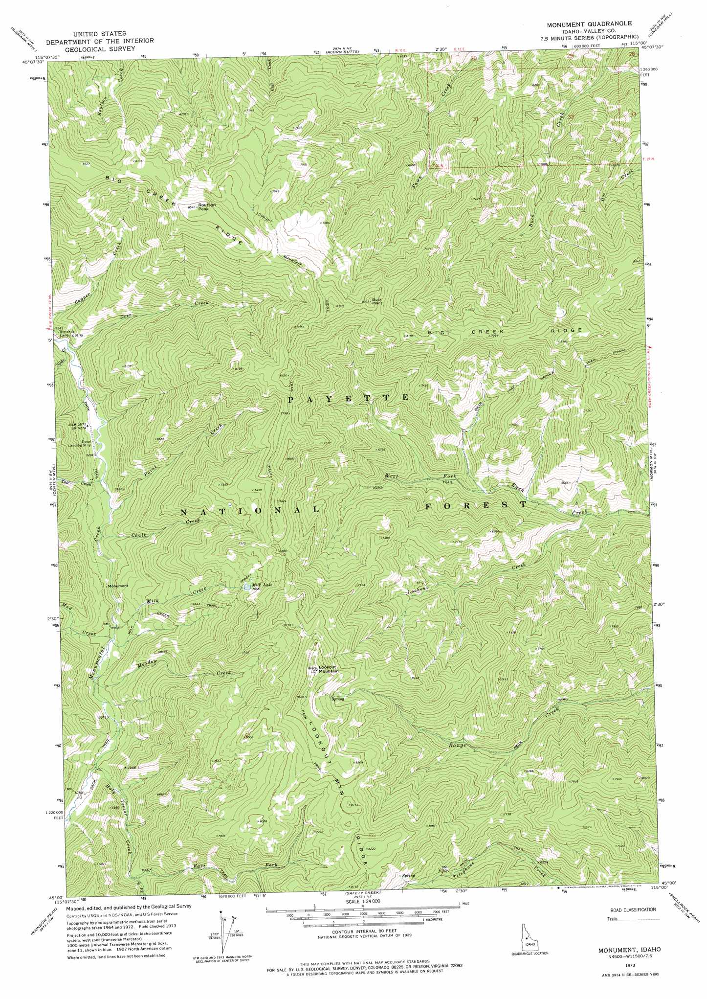
USGS Topo Quad 45115a1 - 1:24,000 scale
| Topo Map Name: | Monument |
| USGS Topo Quad ID: | 45115a1 |
| Print Size: | ca. 21 1/4" wide x 27" high |
| Southeast Coordinates: | 45° N latitude / 115° W longitude |
| Map Center Coordinates: | 45.0625° N latitude / 115.0625° W longitude |
| U.S. State: | ID |
| Filename: | o45115a1.jpg |
| Download Map JPG Image: | Monument topo map 1:24,000 scale |
| Map Type: | Topographic |
| Topo Series: | 7.5´ |
| Map Scale: | 1:24,000 |
| Source of Map Images: | United States Geological Survey (USGS) |
| Alternate Map Versions: |
Monument ID 1973, updated 1975 Download PDF Buy paper map Monument ID 2004, updated 2007 Download PDF Buy paper map Monument ID 2011 Download PDF Buy paper map Monument ID 2013 Download PDF Buy paper map |
| FStopo: | US Forest Service topo Monument is available: Download FStopo PDF Download FStopo TIF |
1:24,000 Topo Quads surrounding Monument
Mosquito Peak |
Lodgepole Creek |
Wapiti Creek |
Cold Meadows |
Cottonwood Butte |
Big Creek |
Bismark Mountain |
Acorn Butte |
Vinegar Hill |
Papoose Peak |
Edwardsburg |
Center Mountain |
Monument |
Mormon Mountain |
Dave Lewis Peak |
Stibnite |
Rainbow Peak |
Safety Creek |
Shellrock Peak |
Bear Creek Point |
Big Chief Creek |
Big Baldy |
Pungo Mountain |
Norton Ridge |
Ramey Hill |
> Back to 45115a1 at 1:100,000 scale
> Back to 45114a1 at 1:250,000 scale
> Back to U.S. Topo Maps home
Monument topo map: Gazetteer
Monument: Lakes
Milk Lake elevation 2155m 7070′Monument: Ridges
Big Creek Ridge elevation 2536m 8320′Monument: Streams
Chalk Creek elevation 1632m 5354′Deer Creek elevation 1582m 5190′
East Fork Holy Terror Creek elevation 1845m 6053′
Holy Terror Creek elevation 1707m 5600′
Lookout Creek elevation 1619m 5311′
Meadow Creek elevation 1683m 5521′
Milk Creek elevation 1670m 5479′
Mud Creek elevation 1669m 5475′
Paint Creek elevation 1622m 5321′
Slide Creek elevation 1582m 5190′
South Fork Holy Terror Creek elevation 1842m 6043′
Talc Creek elevation 1607m 5272′
Monument: Summits
Buck Point elevation 2488m 8162′Lookout Mountain elevation 2636m 8648′
Monument: Trails
Lookout Mountain Ridge Trail elevation 2467m 8093′Milk Creek Trail elevation 1911m 6269′
Monument digital topo map on disk
Buy this Monument topo map showing relief, roads, GPS coordinates and other geographical features, as a high-resolution digital map file on DVD: