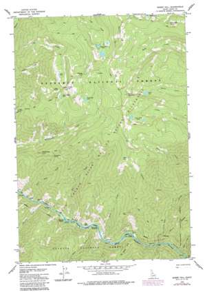
Sheep Hill Topo Map Idaho
To zoom in, hover over the map of Sheep Hill
USGS Topo Quad 45115e1 - 1:24,000 scale
| Topo Map Name: | Sheep Hill |
| USGS Topo Quad ID: | 45115e1 |
| Print Size: | ca. 21 1/4" wide x 27" high |
| Southeast Coordinates: | 45.5° N latitude / 115° W longitude |
| Map Center Coordinates: | 45.5625° N latitude / 115.0625° W longitude |
| U.S. State: | ID |
| Filename: | o45115e1.jpg |
| Download Map JPG Image: | Sheep Hill topo map 1:24,000 scale |
| Map Type: | Topographic |
| Topo Series: | 7.5´ |
| Map Scale: | 1:24,000 |
| Source of Map Images: | United States Geological Survey (USGS) |
| Alternate Map Versions: |
Sheep Hill ID 1978, updated 1978 Download PDF Buy paper map Sheep Hill ID 1978, updated 1987 Download PDF Buy paper map Sheep Hill ID 1995, updated 1999 Download PDF Buy paper map Sheep Hill ID 2011 Download PDF Buy paper map Sheep Hill ID 2013 Download PDF Buy paper map |
| FStopo: | US Forest Service topo Sheep Hill is available: Download FStopo PDF Download FStopo TIF |
1:24,000 Topo Quads surrounding Sheep Hill
> Back to 45115e1 at 1:100,000 scale
> Back to 45114a1 at 1:250,000 scale
> Back to U.S. Topo Maps home
Sheep Hill topo map: Gazetteer
Sheep Hill: Bars
Bear Bar elevation 791m 2595′Deer Park Bar elevation 778m 2552′
Nixon Bar elevation 799m 2621′
Sunny Bar elevation 808m 2650′
Sheep Hill: Capes
Bear Point elevation 2426m 7959′Sheep Hill: Cliffs
Ring Creek Point elevation 2374m 7788′Sheep Hill: Gaps
Dead Man Saddle elevation 2431m 7975′Sheep Hill: Lakes
Brown Lake elevation 2161m 7089′Center Creek Lakes elevation 2260m 7414′
Goat Lake elevation 2287m 7503′
Lake Creek Lakes elevation 2184m 7165′
Rattlesnake Lake elevation 2231m 7319′
Sheep Spring Lake elevation 2360m 7742′
Sheep Hill: Parks
Salmon Wild and Scenic River elevation 832m 2729′Sheep Hill: Rapids
Hancock Rapids elevation 784m 2572′Sheep Hill: Springs
Barth Hot Springs elevation 823m 2700′Rattlesnake Spring elevation 1716m 5629′
Sheep Spring elevation 2385m 7824′
Sheep Hill: Streams
Bear Creek elevation 784m 2572′Black Creek elevation 826m 2709′
Bruin Creek elevation 791m 2595′
Canyon Creek elevation 898m 2946′
Deer Park Creek elevation 794m 2604′
Dillinger Creek elevation 793m 2601′
Hot Springs Creek elevation 805m 2641′
Nixon Creek elevation 808m 2650′
Sabe Creek elevation 805m 2641′
Sheep Hill: Summits
Center Mountain elevation 2510m 8234′Rattlesnake Point elevation 1835m 6020′
Sheep Hill elevation 2546m 8353′
Sheep Hill: Valleys
Black Canyon elevation 804m 2637′Sheep Hill digital topo map on disk
Buy this Sheep Hill topo map showing relief, roads, GPS coordinates and other geographical features, as a high-resolution digital map file on DVD:


