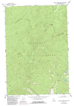
Spread Creek Point Topo Map Idaho
To zoom in, hover over the map of Spread Creek Point
USGS Topo Quad 45115f1 - 1:24,000 scale
| Topo Map Name: | Spread Creek Point |
| USGS Topo Quad ID: | 45115f1 |
| Print Size: | ca. 21 1/4" wide x 27" high |
| Southeast Coordinates: | 45.625° N latitude / 115° W longitude |
| Map Center Coordinates: | 45.6875° N latitude / 115.0625° W longitude |
| U.S. State: | ID |
| Filename: | o45115f1.jpg |
| Download Map JPG Image: | Spread Creek Point topo map 1:24,000 scale |
| Map Type: | Topographic |
| Topo Series: | 7.5´ |
| Map Scale: | 1:24,000 |
| Source of Map Images: | United States Geological Survey (USGS) |
| Alternate Map Versions: |
Spread Creek Point ID 1978, updated 1978 Download PDF Buy paper map Spread Creek Point ID 1978, updated 1987 Download PDF Buy paper map Spread Creek Point ID 1995, updated 1999 Download PDF Buy paper map Spread Creek Point ID 2011 Download PDF Buy paper map Spread Creek Point ID 2013 Download PDF Buy paper map |
| FStopo: | US Forest Service topo Spread Creek Point is available: Download FStopo PDF Download FStopo TIF |
1:24,000 Topo Quads surrounding Spread Creek Point
> Back to 45115e1 at 1:100,000 scale
> Back to 45114a1 at 1:250,000 scale
> Back to U.S. Topo Maps home
Spread Creek Point topo map: Gazetteer
Spread Creek Point: Lakes
Bleak Creek Lake elevation 2198m 7211′Saddle Lake elevation 2240m 7349′
Spread Point Lake elevation 2190m 7185′
Upper Trilby Lake elevation 2176m 7139′
Spread Creek Point: Streams
Bleak Creek elevation 1377m 4517′Cache Creek elevation 1195m 3920′
Green Creek elevation 1544m 5065′
Grouse Creek elevation 1394m 4573′
Hot Springs Creek elevation 1533m 5029′
Lake Creek elevation 1179m 3868′
Poet Creek elevation 1517m 4977′
Porcupine Creek elevation 1410m 4625′
Prospector Creek elevation 1274m 4179′
Root Creek elevation 1510m 4954′
Spread Creek elevation 1259m 4130′
Spring Creek elevation 1232m 4041′
Spread Creek Point: Summits
Grouse Creek Point elevation 1981m 6499′Spread Creek Point elevation 2487m 8159′
Spread Creek Point: Trails
Nez Perce Trail elevation 1721m 5646′Spread Creek Point digital topo map on disk
Buy this Spread Creek Point topo map showing relief, roads, GPS coordinates and other geographical features, as a high-resolution digital map file on DVD:


