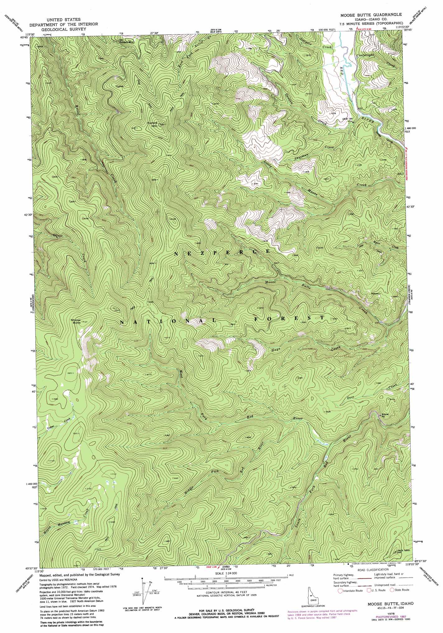
Moose Butte Topo Map Idaho
To zoom in, hover over the map of Moose Butte
USGS Topo Quad 45115f4 - 1:24,000 scale
| Topo Map Name: | Moose Butte |
| USGS Topo Quad ID: | 45115f4 |
| Print Size: | ca. 21 1/4" wide x 27" high |
| Southeast Coordinates: | 45.625° N latitude / 115.375° W longitude |
| Map Center Coordinates: | 45.6875° N latitude / 115.4375° W longitude |
| U.S. State: | ID |
| Filename: | o45115f4.jpg |
| Download Map JPG Image: | Moose Butte topo map 1:24,000 scale |
| Map Type: | Topographic |
| Topo Series: | 7.5´ |
| Map Scale: | 1:24,000 |
| Source of Map Images: | United States Geological Survey (USGS) |
| Alternate Map Versions: |
Moose Butte ID 1978, updated 1978 Download PDF Buy paper map Moose Butte ID 1987, updated 1987 Download PDF Buy paper map Moose Butte ID 1995, updated 1999 Download PDF Buy paper map Moose Butte ID 2011 Download PDF Buy paper map Moose Butte ID 2013 Download PDF Buy paper map |
| FStopo: | US Forest Service topo Moose Butte is available: Download FStopo PDF Download FStopo TIF |
1:24,000 Topo Quads surrounding Moose Butte
Pilot Knob |
Iron Mountain |
Lick Point |
Anderson Butte |
Vermilion Peak |
Golden |
Cener Star Mountain |
Elk City |
Black Hawk Mountain |
Sable Hill |
North Pole |
Orogrande |
Moose Butte |
Trapper Creek |
Boston Mountain |
Buffalo Hump |
Silver Spur Ridge |
Dixie |
Whitewater Ranch |
Hida Point |
Cottontail Point |
Mackay Bar |
Fivemile Bar |
Sheepeater Mountain |
Meadow Of Doubt |
> Back to 45115e1 at 1:100,000 scale
> Back to 45114a1 at 1:250,000 scale
> Back to U.S. Topo Maps home
Moose Butte topo map: Gazetteer
Moose Butte: Mines
Gallagher Mine elevation 1351m 4432′Old Portland Mine elevation 1578m 5177′
Moose Butte: Parks
Moose Meadow Creek Research Natural Area elevation 2117m 6945′Moose Butte: Populated Places
Gibler elevation 1307m 4288′Leprouse elevation 1310m 4297′
Moose Butte: Streams
Cartwright Creek elevation 1290m 4232′Dawson Creek elevation 1303m 4274′
Hays Creek elevation 1387m 4550′
Middle Fork Red River elevation 1596m 5236′
Sharman Creek elevation 1311m 4301′
Sixtysix Creek elevation 1288m 4225′
West Fork Red River elevation 1578m 5177′
Moose Butte: Summits
Jack Mountain elevation 1977m 6486′Moose Butte elevation 2168m 7112′
Porters Mountain elevation 1942m 6371′
Moose Butte digital topo map on disk
Buy this Moose Butte topo map showing relief, roads, GPS coordinates and other geographical features, as a high-resolution digital map file on DVD: