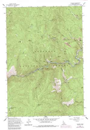
Golden Topo Map Idaho
To zoom in, hover over the map of Golden
USGS Topo Quad 45115g6 - 1:24,000 scale
| Topo Map Name: | Golden |
| USGS Topo Quad ID: | 45115g6 |
| Print Size: | ca. 21 1/4" wide x 27" high |
| Southeast Coordinates: | 45.75° N latitude / 115.625° W longitude |
| Map Center Coordinates: | 45.8125° N latitude / 115.6875° W longitude |
| U.S. State: | ID |
| Filename: | o45115g6.jpg |
| Download Map JPG Image: | Golden topo map 1:24,000 scale |
| Map Type: | Topographic |
| Topo Series: | 7.5´ |
| Map Scale: | 1:24,000 |
| Source of Map Images: | United States Geological Survey (USGS) |
| Alternate Map Versions: |
Golden ID 1962, updated 1964 Download PDF Buy paper map Golden ID 1962, updated 1983 Download PDF Buy paper map Golden ID 1962, updated 1987 Download PDF Buy paper map Golden ID 1995, updated 1999 Download PDF Buy paper map Golden ID 2011 Download PDF Buy paper map Golden ID 2013 Download PDF Buy paper map |
| FStopo: | US Forest Service topo Golden is available: Download FStopo PDF Download FStopo TIF |
1:24,000 Topo Quads surrounding Golden
> Back to 45115e1 at 1:100,000 scale
> Back to 45114a1 at 1:250,000 scale
> Back to U.S. Topo Maps home
Golden topo map: Gazetteer
Golden: Bars
Reed Bar elevation 1036m 3398′Golden: Flats
Lower Twentymile Meadows elevation 1315m 4314′Golden: Mines
Blackbird Mine elevation 1149m 3769′Bluebird Placer Mine elevation 1279m 4196′
Buckhorn Mine elevation 1381m 4530′
Buffalo Idaho Mine elevation 1596m 5236′
Clearwater Mine elevation 1165m 3822′
Easter Mine elevation 1283m 4209′
Fourmile Mine elevation 1343m 4406′
Gilt Edge Mine elevation 1448m 4750′
Leggett Placer Mine elevation 1281m 4202′
Little Leggett Placer Mine elevation 1303m 4274′
Lone Pine Mine elevation 1195m 3920′
Mackey Mine elevation 1714m 5623′
Meador Diggings elevation 1198m 3930′
New York Mine elevation 1478m 4849′
Sentinel Mine elevation 1195m 3920′
Sheelite Mine elevation 1104m 3622′
Wild Hope Mine elevation 1465m 4806′
Wonder Mine elevation 1452m 4763′
Golden: Populated Places
Fall Creek elevation 1069m 3507′Golden elevation 1071m 3513′
Old Golden elevation 1327m 4353′
Golden: Streams
Browns Creek elevation 1056m 3464′Buckhorn Creek elevation 1070m 3510′
Droogs Creek elevation 967m 3172′
Fall Creek elevation 1071m 3513′
Fourmile Creek elevation 1318m 4324′
Harman Creek elevation 1046m 3431′
Left Fork Fall Creek elevation 1608m 5275′
Leggett Creek elevation 1104m 3622′
Little Leggett Creek elevation 1183m 3881′
Mackey Creek elevation 1242m 4074′
Rainy Day Creek elevation 1055m 3461′
Reed Creek elevation 1037m 3402′
Right Fork Fall Creek elevation 1608m 5275′
Santiam Creek elevation 1099m 3605′
Sixmile Creek elevation 1210m 3969′
Tenmile Creek elevation 1051m 3448′
Golden: Summits
Fall Creek Point elevation 1502m 4927′Nellie Mountain elevation 1881m 6171′
Rainy Day Point elevation 1809m 5935′
Reed Mountain elevation 1913m 6276′
Golden: Trails
Nellie Mountain Trail elevation 1772m 5813′Reed Bar Trail elevation 1454m 4770′
Golden digital topo map on disk
Buy this Golden topo map showing relief, roads, GPS coordinates and other geographical features, as a high-resolution digital map file on DVD:


