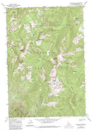
Running Lake Topo Map Idaho
To zoom in, hover over the map of Running Lake
USGS Topo Quad 45115h1 - 1:24,000 scale
| Topo Map Name: | Running Lake |
| USGS Topo Quad ID: | 45115h1 |
| Print Size: | ca. 21 1/4" wide x 27" high |
| Southeast Coordinates: | 45.875° N latitude / 115° W longitude |
| Map Center Coordinates: | 45.9375° N latitude / 115.0625° W longitude |
| U.S. State: | ID |
| Filename: | o45115h1.jpg |
| Download Map JPG Image: | Running Lake topo map 1:24,000 scale |
| Map Type: | Topographic |
| Topo Series: | 7.5´ |
| Map Scale: | 1:24,000 |
| Source of Map Images: | United States Geological Survey (USGS) |
| Alternate Map Versions: |
Running Lake ID 1966, updated 1968 Download PDF Buy paper map Running Lake ID 1966, updated 1979 Download PDF Buy paper map Running Lake ID 1966, updated 1987 Download PDF Buy paper map Running Lake ID 1995, updated 1999 Download PDF Buy paper map Running Lake ID 2011 Download PDF Buy paper map Running Lake ID 2013 Download PDF Buy paper map |
| FStopo: | US Forest Service topo Running Lake is available: Download FStopo PDF Download FStopo TIF |
1:24,000 Topo Quads surrounding Running Lake
> Back to 45115e1 at 1:100,000 scale
> Back to 45114a1 at 1:250,000 scale
> Back to U.S. Topo Maps home
Running Lake topo map: Gazetteer
Running Lake: Flats
Grave Meadow elevation 2141m 7024′Running Lake: Gaps
Windy Saddle elevation 1997m 6551′Running Lake: Lakes
Bilk Lake elevation 2061m 6761′Buck Lake elevation 2139m 7017′
Fawn Lake elevation 1955m 6414′
Goat Lake elevation 2184m 7165′
Red Lake elevation 2030m 6660′
Running Lake elevation 1995m 6545′
Square Rock Lake elevation 1870m 6135′
Running Lake: Streams
East Fork Meadow Creek elevation 1247m 4091′Grave Creek elevation 1562m 5124′
Indian Peak Creek elevation 1692m 5551′
Red Lake Creek elevation 1785m 5856′
Schwar Creek elevation 1150m 3772′
Spook Creek elevation 1452m 4763′
Vermilion Creek elevation 1336m 4383′
Running Lake: Summits
Bilk Mountain elevation 2287m 7503′Elk Mountain elevation 2377m 7798′
Grave Meadow Peak elevation 2188m 7178′
Indian Peak elevation 2340m 7677′
Rock Pillar elevation 2131m 6991′
Rocky Peak elevation 2311m 7582′
Square Rock elevation 2222m 7290′
Running Lake digital topo map on disk
Buy this Running Lake topo map showing relief, roads, GPS coordinates and other geographical features, as a high-resolution digital map file on DVD:


