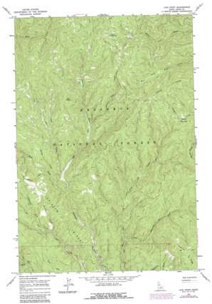
Lick Point Topo Map Idaho
To zoom in, hover over the map of Lick Point
USGS Topo Quad 45115h4 - 1:24,000 scale
| Topo Map Name: | Lick Point |
| USGS Topo Quad ID: | 45115h4 |
| Print Size: | ca. 21 1/4" wide x 27" high |
| Southeast Coordinates: | 45.875° N latitude / 115.375° W longitude |
| Map Center Coordinates: | 45.9375° N latitude / 115.4375° W longitude |
| U.S. State: | ID |
| Filename: | o45115h4.jpg |
| Download Map JPG Image: | Lick Point topo map 1:24,000 scale |
| Map Type: | Topographic |
| Topo Series: | 7.5´ |
| Map Scale: | 1:24,000 |
| Source of Map Images: | United States Geological Survey (USGS) |
| Alternate Map Versions: |
Lick Point ID 1966, updated 1968 Download PDF Buy paper map Lick Point ID 1966, updated 1987 Download PDF Buy paper map Lick Point ID 1995, updated 1999 Download PDF Buy paper map Lick Point ID 2011 Download PDF Buy paper map Lick Point ID 2013 Download PDF Buy paper map |
| FStopo: | US Forest Service topo Lick Point is available: Download FStopo PDF Download FStopo TIF |
1:24,000 Topo Quads surrounding Lick Point
> Back to 45115e1 at 1:100,000 scale
> Back to 45114a1 at 1:250,000 scale
> Back to U.S. Topo Maps home
Lick Point topo map: Gazetteer
Lick Point: Flats
Buck Meadows elevation 1710m 5610′Marten Meadows elevation 1538m 5045′
Lick Point: Parks
Horse Creek Administrative Research Area elevation 1461m 4793′Lick Point: Populated Places
York elevation 1460m 4790′Lick Point: Ridges
Ericson Ridge elevation 1403m 4603′Flatiron Ridge elevation 1807m 5928′
Lick Point: Streams
Ericson Creek elevation 1308m 4291′Flint Creek elevation 1302m 4271′
Lick Creek elevation 1318m 4324′
Lightning Fork Little Elk Creek elevation 1319m 4327′
Limber Luke Creek elevation 1352m 4435′
Rumpus Creek elevation 1359m 4458′
Spring Creek elevation 1318m 4324′
West Fork American River elevation 1313m 4307′
West Fork Big Elk Creek elevation 1303m 4274′
Lick Point: Summits
Lick Point elevation 1600m 5249′Lick Point digital topo map on disk
Buy this Lick Point topo map showing relief, roads, GPS coordinates and other geographical features, as a high-resolution digital map file on DVD:


