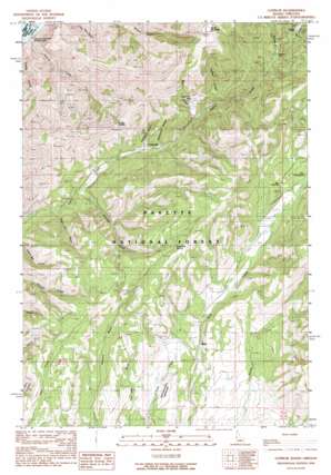
Cuprum Topo Map Idaho
To zoom in, hover over the map of Cuprum
USGS Topo Quad 45116a6 - 1:24,000 scale
| Topo Map Name: | Cuprum |
| USGS Topo Quad ID: | 45116a6 |
| Print Size: | ca. 21 1/4" wide x 27" high |
| Southeast Coordinates: | 45° N latitude / 116.625° W longitude |
| Map Center Coordinates: | 45.0625° N latitude / 116.6875° W longitude |
| U.S. States: | ID, OR |
| Filename: | o45116a6.jpg |
| Download Map JPG Image: | Cuprum topo map 1:24,000 scale |
| Map Type: | Topographic |
| Topo Series: | 7.5´ |
| Map Scale: | 1:24,000 |
| Source of Map Images: | United States Geological Survey (USGS) |
| Alternate Map Versions: |
Cuprum ID 1990, updated 1990 Download PDF Buy paper map Cuprum ID 2004, updated 2007 Download PDF Buy paper map Cuprum ID 2011 Download PDF Buy paper map Cuprum ID 2013 Download PDF Buy paper map |
| FStopo: | US Forest Service topo Cuprum is available: Download FStopo PDF Download FStopo TIF |
1:24,000 Topo Quads surrounding Cuprum
> Back to 45116a1 at 1:100,000 scale
> Back to 45116a1 at 1:250,000 scale
> Back to U.S. Topo Maps home
Cuprum topo map: Gazetteer
Cuprum: Airports
Seven Devils Airport elevation 1367m 4484′Seven Devils Ranch Landing Strip elevation 1367m 4484′
Cuprum: Dams
Copper Cliffs Tailings Dam elevation 1507m 4944′Silver King Mines Number One Dam elevation 1463m 4799′
Cuprum: Gaps
Lynes Saddle elevation 1517m 4977′Cuprum: Mines
Copper Cliff Mine elevation 1462m 4796′Cuprum: Populated Places
Bear elevation 1347m 4419′Cuprum elevation 1310m 4297′
Landore elevation 1637m 5370′
Cuprum: Post Offices
Landore Post Office (historical) elevation 1637m 5370′Cuprum: Springs
Stockade Spring elevation 1549m 5082′Cuprum: Streams
Garnet Creek elevation 1562m 5124′Ladder Creek elevation 1452m 4763′
Mann Creek elevation 1365m 4478′
Placer Creek elevation 1606m 5269′
Cuprum: Summits
Horse Mountain elevation 2102m 6896′Cuprum: Valleys
Hathaway Gulch elevation 1309m 4294′Hitchcock Gulch elevation 1314m 4311′
Huntley Gulch elevation 1229m 4032′
Negro Jim Gulch elevation 1222m 4009′
Cuprum digital topo map on disk
Buy this Cuprum topo map showing relief, roads, GPS coordinates and other geographical features, as a high-resolution digital map file on DVD:


