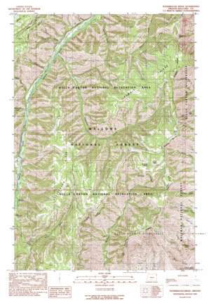
Puderbaugh Ridge Topo Map Oregon
To zoom in, hover over the map of Puderbaugh Ridge
USGS Topo Quad 45116b7 - 1:24,000 scale
| Topo Map Name: | Puderbaugh Ridge |
| USGS Topo Quad ID: | 45116b7 |
| Print Size: | ca. 21 1/4" wide x 27" high |
| Southeast Coordinates: | 45.125° N latitude / 116.75° W longitude |
| Map Center Coordinates: | 45.1875° N latitude / 116.8125° W longitude |
| U.S. State: | OR |
| Filename: | o45116b7.jpg |
| Download Map JPG Image: | Puderbaugh Ridge topo map 1:24,000 scale |
| Map Type: | Topographic |
| Topo Series: | 7.5´ |
| Map Scale: | 1:24,000 |
| Source of Map Images: | United States Geological Survey (USGS) |
| Alternate Map Versions: |
Puderbaugh Ridge OR 1990, updated 1990 Download PDF Buy paper map Puderbaugh Ridge OR 2011 Download PDF Buy paper map Puderbaugh Ridge OR 2014 Download PDF Buy paper map |
| FStopo: | US Forest Service topo Puderbaugh Ridge is available: Download FStopo PDF Download FStopo TIF |
1:24,000 Topo Quads surrounding Puderbaugh Ridge
> Back to 45116a1 at 1:100,000 scale
> Back to 45116a1 at 1:250,000 scale
> Back to U.S. Topo Maps home
Puderbaugh Ridge topo map: Gazetteer
Puderbaugh Ridge: Dams
Imnaha Fish Weir elevation 1159m 3802′Puderbaugh Ridge: Gaps
P O Saddle elevation 1749m 5738′Puderbaugh Ridge: Populated Places
Fruita elevation 1103m 3618′Puderbaugh Ridge: Post Offices
Fruita Post Office (historical) elevation 1103m 3618′Puderbaugh Ridge: Ridges
Puderbaugh Ridge elevation 1723m 5652′Puderbaugh Ridge: Springs
McGraw Spring elevation 1781m 5843′Puderbaugh Ridge: Streams
Blackhorse Creek elevation 1203m 3946′Crazyman Creek elevation 1092m 3582′
Grizzly Creek elevation 1050m 3444′
Gumboot Creek elevation 1194m 3917′
Henry Creek elevation 1083m 3553′
Mahogany Creek elevation 1185m 3887′
Nine Point Creek elevation 1117m 3664′
North Fork Dry Creek elevation 1288m 4225′
P O Creek elevation 1462m 4796′
Spring Creek elevation 1102m 3615′
Puderbaugh Ridge: Valleys
Keener Gulch elevation 1062m 3484′Puderbaugh Ridge digital topo map on disk
Buy this Puderbaugh Ridge topo map showing relief, roads, GPS coordinates and other geographical features, as a high-resolution digital map file on DVD:


