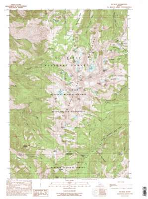
He Devil Topo Map Idaho
To zoom in, hover over the map of He Devil
USGS Topo Quad 45116c5 - 1:24,000 scale
| Topo Map Name: | He Devil |
| USGS Topo Quad ID: | 45116c5 |
| Print Size: | ca. 21 1/4" wide x 27" high |
| Southeast Coordinates: | 45.25° N latitude / 116.5° W longitude |
| Map Center Coordinates: | 45.3125° N latitude / 116.5625° W longitude |
| U.S. State: | ID |
| Filename: | o45116c5.jpg |
| Download Map JPG Image: | He Devil topo map 1:24,000 scale |
| Map Type: | Topographic |
| Topo Series: | 7.5´ |
| Map Scale: | 1:24,000 |
| Source of Map Images: | United States Geological Survey (USGS) |
| Alternate Map Versions: |
He Devil ID 1990, updated 1990 Download PDF Buy paper map He Devil ID 1990, updated 1990 Download PDF Buy paper map He Devil ID 1995, updated 1999 Download PDF Buy paper map He Devil ID 1995, updated 2007 Download PDF Buy paper map He Devil ID 2011 Download PDF Buy paper map He Devil ID 2013 Download PDF Buy paper map |
| FStopo: | US Forest Service topo He Devil is available: Download FStopo PDF Download FStopo TIF |
1:24,000 Topo Quads surrounding He Devil
> Back to 45116a1 at 1:100,000 scale
> Back to 45116a1 at 1:250,000 scale
> Back to U.S. Topo Maps home
He Devil topo map: Gazetteer
He Devil: Gaps
Stevens Saddle elevation 2287m 7503′He Devil: Lakes
Appendix Lake elevation 2424m 7952′Baldy Lake elevation 2196m 7204′
Basin Lake elevation 2251m 7385′
Dog Lake elevation 2412m 7913′
Echo Lake elevation 2209m 7247′
Gem Lake elevation 2368m 7769′
Haas Lake elevation 2216m 7270′
Hanson Lakes elevation 2364m 7755′
He Devil Lake elevation 2288m 7506′
Horse Heaven Lake elevation 2288m 7506′
Lily Pad Lake elevation 2262m 7421′
Lower Cannon Lake elevation 2144m 7034′
Mirror Lake elevation 2447m 8028′
Purgatory Lake elevation 2423m 7949′
Quad Lake elevation 2230m 7316′
Rock Island Lake elevation 2424m 7952′
Seven Devils Lake elevation 2315m 7595′
Sheep Lake elevation 2404m 7887′
Shelf Lake elevation 2275m 7463′
Slide Rock Lake elevation 2412m 7913′
Triangle Lake elevation 2301m 7549′
Upper Cannon Lake elevation 2472m 8110′
He Devil: Populated Places
Rankin Mill elevation 1807m 5928′He Devil: Ranges
Seven Devils Mountains elevation 2825m 9268′He Devil: Ridges
Dry Diggins Ridge elevation 2255m 7398′He Devil: Springs
Oxbow Spring elevation 2111m 6925′Saddle Spring elevation 1160m 3805′
He Devil: Streams
Anchor Creek elevation 1626m 5334′Dog Creek elevation 1659m 5442′
Fall Creek elevation 1327m 4353′
Mill Creek elevation 1807m 5928′
Oxbow Creek elevation 1474m 4835′
Two Creek elevation 1220m 4002′
He Devil: Summits
Carbonate Hill elevation 2481m 8139′Devils Throne elevation 2757m 9045′
Devils Tooth elevation 2316m 7598′
Granite Mountain elevation 2432m 7979′
He Devil elevation 2838m 9311′
Horse Heaven elevation 1983m 6505′
Mount Belial elevation 2689m 8822′
Potato Hill elevation 2480m 8136′
Pyramid Mountain elevation 2636m 8648′
She Devil elevation 2817m 9242′
The Goblin elevation 2705m 8874′
The Ogre elevation 2811m 9222′
Tower of Babel elevation 2779m 9117′
Twin Imps elevation 2597m 8520′
He Devil: Trails
Heavens Gate Trail (historical) elevation 2393m 7851′Old Boise Trail elevation 2215m 7267′
He Devil digital topo map on disk
Buy this He Devil topo map showing relief, roads, GPS coordinates and other geographical features, as a high-resolution digital map file on DVD:


