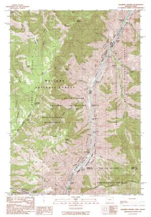
Squirrel Prairie Topo Map Oregon
To zoom in, hover over the map of Squirrel Prairie
USGS Topo Quad 45116c6 - 1:24,000 scale
| Topo Map Name: | Squirrel Prairie |
| USGS Topo Quad ID: | 45116c6 |
| Print Size: | ca. 21 1/4" wide x 27" high |
| Southeast Coordinates: | 45.25° N latitude / 116.625° W longitude |
| Map Center Coordinates: | 45.3125° N latitude / 116.6875° W longitude |
| U.S. States: | OR, ID |
| Filename: | o45116c6.jpg |
| Download Map JPG Image: | Squirrel Prairie topo map 1:24,000 scale |
| Map Type: | Topographic |
| Topo Series: | 7.5´ |
| Map Scale: | 1:24,000 |
| Source of Map Images: | United States Geological Survey (USGS) |
| Alternate Map Versions: |
Squirrel Prairie OR 1990, updated 1990 Download PDF Buy paper map Squirrel Prairie OR 1995, updated 1999 Download PDF Buy paper map Squirrel Prairie OR 2011 Download PDF Buy paper map Squirrel Prairie OR 2014 Download PDF Buy paper map |
| FStopo: | US Forest Service topo Squirrel Prairie is available: Download FStopo PDF Download FStopo TIF |
1:24,000 Topo Quads surrounding Squirrel Prairie
> Back to 45116a1 at 1:100,000 scale
> Back to 45116a1 at 1:250,000 scale
> Back to U.S. Topo Maps home
Squirrel Prairie topo map: Gazetteer
Squirrel Prairie: Bars
Chimney Bar elevation 453m 1486′Chimney Bar elevation 569m 1866′
Rock Bar elevation 426m 1397′
Two Bars elevation 693m 2273′
Warm Springs Bar elevation 456m 1496′
Squirrel Prairie: Flats
Squirrel Prairie elevation 2088m 6850′Squirrel Prairie: Gaps
Brush Creek Saddle elevation 1775m 5823′Chimney Saddle elevation 1402m 4599′
Squirrel Prairie: Rapids
Brush Creek Rapids elevation 439m 1440′Cliff Mountain Rapids elevation 458m 1502′
Cliff Mountain Rapids elevation 458m 1502′
Granite Creek Rapids elevation 604m 1981′
Granite Rapids elevation 454m 1489′
Hells Canyon Rapids elevation 466m 1528′
Rocky Point Rapids elevation 436m 1430′
Rocky Point Rapids elevation 436m 1430′
Three Creek Rapids elevation 416m 1364′
Wild Sheep Rapids elevation 427m 1400′
Wild Sheep Rapids elevation 594m 1948′
Squirrel Prairie: Ridges
Rocky Point elevation 580m 1902′Squirrel Prairie: Springs
Benjamin Spring elevation 2081m 6827′Coyote Spring elevation 1576m 5170′
Coyote Spring elevation 1970m 6463′
Hintmelwright Spring elevation 1889m 6197′
Jensen Spring elevation 1927m 6322′
Lamont Spring elevation 523m 1715′
Lamont Springs elevation 1001m 3284′
Squirrel Prairie: Streams
Battle Creek elevation 433m 1420′Beaver Dam Creek elevation 735m 2411′
Brush Creek elevation 440m 1443′
Bull Creek elevation 431m 1414′
Cache Creek elevation 420m 1377′
Devils Farm Creek elevation 858m 2814′
Granite Creek elevation 424m 1391′
Hells Canyon Creek elevation 463m 1519′
Little Granite Creek elevation 548m 1797′
Stud Creek elevation 451m 1479′
Three Creek elevation 415m 1361′
Wild Sheep Creek elevation 427m 1400′
Squirrel Prairie: Summits
Barton Heights elevation 1750m 5741′Bear Mountain elevation 2086m 6843′
Black Mountain elevation 2093m 6866′
Cliff Mountain elevation 2261m 7417′
Lookout Mountain elevation 2079m 6820′
Squirrel Prairie: Valleys
Coon Gulch elevation 782m 2565′Hells Canyon elevation 422m 1384′
Slaughter Gulch elevation 789m 2588′
Squirrel Prairie digital topo map on disk
Buy this Squirrel Prairie topo map showing relief, roads, GPS coordinates and other geographical features, as a high-resolution digital map file on DVD:


