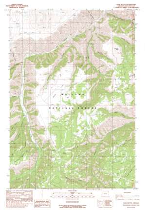
Harl Butte Topo Map Oregon
To zoom in, hover over the map of Harl Butte
USGS Topo Quad 45116c8 - 1:24,000 scale
| Topo Map Name: | Harl Butte |
| USGS Topo Quad ID: | 45116c8 |
| Print Size: | ca. 21 1/4" wide x 27" high |
| Southeast Coordinates: | 45.25° N latitude / 116.875° W longitude |
| Map Center Coordinates: | 45.3125° N latitude / 116.9375° W longitude |
| U.S. State: | OR |
| Filename: | o45116c8.jpg |
| Download Map JPG Image: | Harl Butte topo map 1:24,000 scale |
| Map Type: | Topographic |
| Topo Series: | 7.5´ |
| Map Scale: | 1:24,000 |
| Source of Map Images: | United States Geological Survey (USGS) |
| Alternate Map Versions: |
Harl Butte OR 1990, updated 1990 Download PDF Buy paper map Harl Butte OR 2011 Download PDF Buy paper map Harl Butte OR 2014 Download PDF Buy paper map |
| FStopo: | US Forest Service topo Harl Butte is available: Download FStopo PDF Download FStopo TIF |
1:24,000 Topo Quads surrounding Harl Butte
> Back to 45116a1 at 1:100,000 scale
> Back to 45116a1 at 1:250,000 scale
> Back to U.S. Topo Maps home
Harl Butte topo map: Gazetteer
Harl Butte: Flats
Marr Flat elevation 1615m 5298′Harl Butte: Populated Places
Armin (historical) elevation 1181m 3874′Harl Butte: Post Offices
Armin Post Office (historical) elevation 1181m 3874′Harl Butte: Ridges
Bunch Point elevation 1517m 4977′Harl Butte: Springs
Double Hitch Spring elevation 1639m 5377′Spoon Spring elevation 1633m 5357′
Harl Butte: Streams
Carrol Creek elevation 1194m 3917′Coyote Creek elevation 1122m 3681′
East Fork Squaw Creek elevation 1149m 3769′
Griffith Creek elevation 1164m 3818′
Marr Creek elevation 1026m 3366′
Morgan Creek elevation 1281m 4202′
Needham Creek elevation 1095m 3592′
North Fork Carrol Creek elevation 1218m 3996′
Road Creek elevation 1212m 3976′
South Fork Squaw Creek elevation 1134m 3720′
Squaw Creek elevation 996m 3267′
Timber Creek elevation 1051m 3448′
Harl Butte: Summits
Harl Butte elevation 1846m 6056′Needham Butte elevation 1734m 5688′
Harl Butte: Valleys
Cumming Gulch elevation 1190m 3904′Dixie Jett Gulch elevation 1004m 3293′
Needham Gulch elevation 1333m 4373′
Harl Butte digital topo map on disk
Buy this Harl Butte topo map showing relief, roads, GPS coordinates and other geographical features, as a high-resolution digital map file on DVD:


