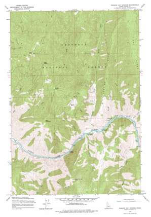
Riggins Hot Springs Topo Map Idaho
To zoom in, hover over the map of Riggins Hot Springs
USGS Topo Quad 45116d2 - 1:24,000 scale
| Topo Map Name: | Riggins Hot Springs |
| USGS Topo Quad ID: | 45116d2 |
| Print Size: | ca. 21 1/4" wide x 27" high |
| Southeast Coordinates: | 45.375° N latitude / 116.125° W longitude |
| Map Center Coordinates: | 45.4375° N latitude / 116.1875° W longitude |
| U.S. State: | ID |
| Filename: | o45116d2.jpg |
| Download Map JPG Image: | Riggins Hot Springs topo map 1:24,000 scale |
| Map Type: | Topographic |
| Topo Series: | 7.5´ |
| Map Scale: | 1:24,000 |
| Source of Map Images: | United States Geological Survey (USGS) |
| Alternate Map Versions: |
Riggins Hot Springs ID 1964, updated 1966 Download PDF Buy paper map Riggins Hot Springs ID 1964, updated 1978 Download PDF Buy paper map Riggins Hot Springs ID 1995, updated 1999 Download PDF Buy paper map Riggins Hot Springs ID 2011 Download PDF Buy paper map Riggins Hot Springs ID 2013 Download PDF Buy paper map |
| FStopo: | US Forest Service topo Riggins Hot Springs is available: Download FStopo PDF Download FStopo TIF |
1:24,000 Topo Quads surrounding Riggins Hot Springs
> Back to 45116a1 at 1:100,000 scale
> Back to 45116a1 at 1:250,000 scale
> Back to U.S. Topo Maps home
Riggins Hot Springs topo map: Gazetteer
Riggins Hot Springs: Bars
Music Bar elevation 556m 1824′Spring Bar elevation 561m 1840′
Riggins Hot Springs: Basins
Rooney Basin elevation 1399m 4589′Riggins Hot Springs: Bridges
Partridge Creek Bridge elevation 577m 1893′Riggins Hot Springs: Gaps
Deep Saddle elevation 1809m 5935′Squaw Saddle elevation 1735m 5692′
Riggins Hot Springs: Populated Places
Riggins Hot Springs elevation 561m 1840′Riggins Hot Springs: Rapids
Ruby Rapids elevation 546m 1791′Riggins Hot Springs: Ridges
Keating Ridge elevation 1388m 4553′Van Ridge elevation 1918m 6292′
Riggins Hot Springs: Streams
Allison Creek elevation 563m 1847′Cat Creek elevation 535m 1755′
East Fork Berg Creek elevation 785m 2575′
Gus Creek elevation 556m 1824′
Kelly Creek elevation 558m 1830′
Lake Creek elevation 543m 1781′
Partridge Creek elevation 554m 1817′
Plant Creek elevation 707m 2319′
Ranch Creek elevation 640m 2099′
Rough Creek elevation 545m 1788′
Spring Creek elevation 561m 1840′
Van Creek elevation 560m 1837′
Warm Springs Creek elevation 551m 1807′
West Fork Allison Creek elevation 833m 2732′
West Fork Lake Creek elevation 821m 2693′
Riggins Hot Springs: Summits
Berg Mountain elevation 1832m 6010′Chair Point elevation 2111m 6925′
Padrick Ridge elevation 1781m 5843′
Warm Springs Point elevation 1773m 5816′
Riggins Hot Springs: Valleys
Box Canyon elevation 692m 2270′Riggins Hot Springs digital topo map on disk
Buy this Riggins Hot Springs topo map showing relief, roads, GPS coordinates and other geographical features, as a high-resolution digital map file on DVD:


