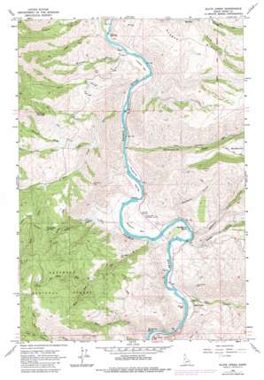
Slate Creek Topo Map Idaho
To zoom in, hover over the map of Slate Creek
USGS Topo Quad 45116f3 - 1:24,000 scale
| Topo Map Name: | Slate Creek |
| USGS Topo Quad ID: | 45116f3 |
| Print Size: | ca. 21 1/4" wide x 27" high |
| Southeast Coordinates: | 45.625° N latitude / 116.25° W longitude |
| Map Center Coordinates: | 45.6875° N latitude / 116.3125° W longitude |
| U.S. State: | ID |
| Filename: | o45116f3.jpg |
| Download Map JPG Image: | Slate Creek topo map 1:24,000 scale |
| Map Type: | Topographic |
| Topo Series: | 7.5´ |
| Map Scale: | 1:24,000 |
| Source of Map Images: | United States Geological Survey (USGS) |
| Alternate Map Versions: |
Slate Creek ID 1963, updated 1965 Download PDF Buy paper map Slate Creek ID 1963, updated 1977 Download PDF Buy paper map Slate Creek ID 1963, updated 1982 Download PDF Buy paper map Slate Creek ID 1995, updated 1999 Download PDF Buy paper map Slate Creek ID 2011 Download PDF Buy paper map Slate Creek ID 2013 Download PDF Buy paper map |
| FStopo: | US Forest Service topo Slate Creek is available: Download FStopo PDF Download FStopo TIF |
1:24,000 Topo Quads surrounding Slate Creek
> Back to 45116e1 at 1:100,000 scale
> Back to 45116a1 at 1:250,000 scale
> Back to U.S. Topo Maps home
Slate Creek topo map: Gazetteer
Slate Creek: Airports
Slate Creek Airport elevation 513m 1683′Slate Creek: Bars
Blackhawk Bar elevation 489m 1604′Campbell Flat elevation 450m 1476′
Cooper Bar elevation 452m 1482′
Large Bar elevation 461m 1512′
Russell Bar elevation 465m 1525′
Slicker Bar elevation 470m 1541′
Taylor Bar elevation 463m 1519′
Wilson Bar elevation 461m 1512′
Slate Creek: Bends
Horse Bend elevation 492m 1614′Horseshoe Bend elevation 457m 1499′
Slate Creek: Gaps
Riverview Saddle elevation 1090m 3576′Slate Creek: Populated Places
Slate Creek elevation 474m 1555′Slate Creek: Rapids
Blackhawk Rapids elevation 473m 1551′Slate Creek: Springs
Joe Spring elevation 1511m 4957′Slate Creek: Streams
Deer Creek elevation 459m 1505′East Fork Deer Creek elevation 762m 2500′
Howard Creek elevation 699m 2293′
Joe Creek elevation 940m 3083′
Johnson Creek elevation 954m 3129′
Lyon Creek elevation 459m 1505′
McKinzie Creek elevation 458m 1502′
North Fork Christie Creek elevation 1251m 4104′
North Fork Joe Creek elevation 939m 3080′
North Fork Skookumchuck Creek elevation 650m 2132′
Poe Creek elevation 602m 1975′
Rhett Creek elevation 473m 1551′
Shuck Creek elevation 442m 1450′
Skookumchuck Creek elevation 448m 1469′
Slate Creek elevation 471m 1545′
Slippy Creek elevation 465m 1525′
Sotin Creek elevation 475m 1558′
South Fork Christie Creek elevation 1258m 4127′
South Fork Joe Creek elevation 940m 3083′
South Fork Skookumchuck Creek elevation 650m 2132′
Slate Creek: Summits
Haystack Mountain elevation 1244m 4081′Slate Creek: Valleys
Bracket Gulch elevation 467m 1532′Robber Gulch elevation 459m 1505′
South Fork Baker Gulch elevation 615m 2017′
Slate Creek digital topo map on disk
Buy this Slate Creek topo map showing relief, roads, GPS coordinates and other geographical features, as a high-resolution digital map file on DVD:


