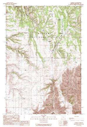
Zumwalt Topo Map Oregon
To zoom in, hover over the map of Zumwalt
USGS Topo Quad 45116f8 - 1:24,000 scale
| Topo Map Name: | Zumwalt |
| USGS Topo Quad ID: | 45116f8 |
| Print Size: | ca. 21 1/4" wide x 27" high |
| Southeast Coordinates: | 45.625° N latitude / 116.875° W longitude |
| Map Center Coordinates: | 45.6875° N latitude / 116.9375° W longitude |
| U.S. State: | OR |
| Filename: | o45116f8.jpg |
| Download Map JPG Image: | Zumwalt topo map 1:24,000 scale |
| Map Type: | Topographic |
| Topo Series: | 7.5´ |
| Map Scale: | 1:24,000 |
| Source of Map Images: | United States Geological Survey (USGS) |
| Alternate Map Versions: |
Zumwalt OR 1990, updated 1990 Download PDF Buy paper map Zumwalt OR 2011 Download PDF Buy paper map Zumwalt OR 2014 Download PDF Buy paper map |
| FStopo: | US Forest Service topo Zumwalt is available: Download FStopo PDF Download FStopo TIF |
1:24,000 Topo Quads surrounding Zumwalt
> Back to 45116e1 at 1:100,000 scale
> Back to 45116a1 at 1:250,000 scale
> Back to U.S. Topo Maps home
Zumwalt topo map: Gazetteer
Zumwalt: Arroyos
Veats Draw elevation 1355m 4445′Zumwalt: Flats
Thomason Meadow elevation 1405m 4609′Zumwalt: Populated Places
Zumwalt elevation 1394m 4573′Zumwalt: Post Offices
Zumwalt Post Office (historical) elevation 1394m 4573′Zumwalt: Reservoirs
Berland Reservoir elevation 1454m 4770′Davis Spring Reservoir elevation 1369m 4491′
Purvis Ponds elevation 1426m 4678′
Thomason Meadow Reservoir elevation 1412m 4632′
Zumwalt: Ridges
Cayuse Ridge elevation 1360m 4461′Mitchell Ridge elevation 1456m 4776′
Zumwalt: Springs
Rice Corral Spring elevation 1541m 5055′Zumwalt: Streams
South Fork Chesnimnus Creek elevation 1389m 4557′Zumwalt: Valleys
Tamarack Gulch elevation 1360m 4461′Vance Draw elevation 1316m 4317′
Zumwalt digital topo map on disk
Buy this Zumwalt topo map showing relief, roads, GPS coordinates and other geographical features, as a high-resolution digital map file on DVD:


