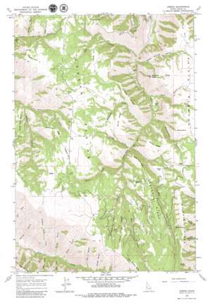
Joseph Topo Map Idaho
To zoom in, hover over the map of Joseph
USGS Topo Quad 45116g4 - 1:24,000 scale
| Topo Map Name: | Joseph |
| USGS Topo Quad ID: | 45116g4 |
| Print Size: | ca. 21 1/4" wide x 27" high |
| Southeast Coordinates: | 45.75° N latitude / 116.375° W longitude |
| Map Center Coordinates: | 45.8125° N latitude / 116.4375° W longitude |
| U.S. State: | ID |
| Filename: | o45116g4.jpg |
| Download Map JPG Image: | Joseph topo map 1:24,000 scale |
| Map Type: | Topographic |
| Topo Series: | 7.5´ |
| Map Scale: | 1:24,000 |
| Source of Map Images: | United States Geological Survey (USGS) |
| Alternate Map Versions: |
Joseph ID 1963, updated 1965 Download PDF Buy paper map Joseph ID 2010 Download PDF Buy paper map Joseph ID 2013 Download PDF Buy paper map |
1:24,000 Topo Quads surrounding Joseph
> Back to 45116e1 at 1:100,000 scale
> Back to 45116a1 at 1:250,000 scale
> Back to U.S. Topo Maps home
Joseph topo map: Gazetteer
Joseph: Basins
Crows Nest Basin elevation 1045m 3428′Joseph: Capes
Fick Point elevation 1210m 3969′Rose Lewis Point elevation 1223m 4012′
Joseph: Flats
Box Flat elevation 743m 2437′Kidder Flat elevation 871m 2857′
Lacey Flat elevation 909m 2982′
Pimble Point elevation 1397m 4583′
Reed Point elevation 1311m 4301′
Shillam Flat elevation 1268m 4160′
Twogood Flat elevation 1329m 4360′
Joseph: Gaps
Deadhorse Saddle elevation 1256m 4120′Shuck Saddle elevation 1518m 4980′
Joseph: Populated Places
Joseph elevation 1363m 4471′Joseph: Ridges
Abercombie Ridge elevation 1343m 4406′Biddle Ridge elevation 1291m 4235′
Center Ridge elevation 1331m 4366′
Grouse Ridge elevation 1209m 3966′
Kerlee Ridge elevation 1258m 4127′
Saddle Horse Ridge elevation 1417m 4648′
Joseph: Springs
Lyda Spring elevation 1311m 4301′Sheep Spring elevation 1407m 4616′
Joseph: Streams
Brust Creek elevation 1031m 3382′Center Creek elevation 1119m 3671′
Fall Creek elevation 687m 2253′
Rail Creek elevation 963m 3159′
Scully Creek elevation 964m 3162′
Soldiers Home Creek elevation 758m 2486′
Joseph: Summits
Fall Point elevation 1168m 3832′Mockmer Butte elevation 1190m 3904′
Mollie Point elevation 1362m 4468′
Joseph: Valleys
Annie Gulch elevation 847m 2778′Bear Gulch elevation 848m 2782′
Big Gulch elevation 992m 3254′
Blind Gulch elevation 819m 2687′
Christmas Tree Gulch elevation 1253m 4110′
Dewey Gulch elevation 1231m 4038′
Garden Gulch elevation 769m 2522′
Gibbons Canyon elevation 1058m 3471′
Gillespie Gulch elevation 1142m 3746′
Moonshine Canyon elevation 874m 2867′
Nelson Gulch elevation 1046m 3431′
Seven Springs Canyon elevation 686m 2250′
Talbot Gulch elevation 1146m 3759′
Wells Gulch elevation 817m 2680′
Joseph digital topo map on disk
Buy this Joseph topo map showing relief, roads, GPS coordinates and other geographical features, as a high-resolution digital map file on DVD:


