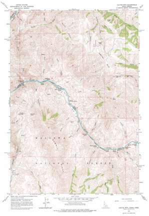
Cactus Mountain Topo Map Idaho
To zoom in, hover over the map of Cactus Mountain
USGS Topo Quad 45116g6 - 1:24,000 scale
| Topo Map Name: | Cactus Mountain |
| USGS Topo Quad ID: | 45116g6 |
| Print Size: | ca. 21 1/4" wide x 27" high |
| Southeast Coordinates: | 45.75° N latitude / 116.625° W longitude |
| Map Center Coordinates: | 45.8125° N latitude / 116.6875° W longitude |
| U.S. States: | ID, OR |
| Filename: | o45116g6.jpg |
| Download Map JPG Image: | Cactus Mountain topo map 1:24,000 scale |
| Map Type: | Topographic |
| Topo Series: | 7.5´ |
| Map Scale: | 1:24,000 |
| Source of Map Images: | United States Geological Survey (USGS) |
| Alternate Map Versions: |
Cactus Mtn OR 1963, updated 1964 Download PDF Buy paper map Cactus Mtn OR 1963, updated 1976 Download PDF Buy paper map Cactus Mountain OR 2011 Download PDF Buy paper map Cactus Mountain OR 2014 Download PDF Buy paper map |
| FStopo: | US Forest Service topo Cactus Mountain is available: Download FStopo PDF Download FStopo TIF |
1:24,000 Topo Quads surrounding Cactus Mountain
> Back to 45116e1 at 1:100,000 scale
> Back to 45116a1 at 1:250,000 scale
> Back to U.S. Topo Maps home
Cactus Mountain topo map: Gazetteer
Cactus Mountain: Airports
Spencer Ranch Landing Strip elevation 1307m 4288′Cactus Mountain: Bars
Dug Bar elevation 310m 1017′Cactus Mountain: Bridges
Cow Creek Bridge elevation 358m 1174′Cactus Mountain: Gaps
Lone Pine Saddle elevation 820m 2690′Cactus Mountain: Islands
Dry Creek Island elevation 314m 1030′Cactus Mountain: Rapids
Big Sulphur Rapids elevation 309m 1013′Big Sulphur Rapids elevation 309m 1013′
Boulder Rapids elevation 307m 1007′
Boulder Rapids elevation 307m 1007′
Deep Creek Rapids elevation 306m 1003′
Deep Creek Rapids elevation 306m 1003′
Divide Creek Rapids elevation 292m 958′
Divide Creek Rapids elevation 292m 958′
Dug Creek Rapids elevation 303m 994′
Dug Creek Rapids elevation 303m 994′
Lower Dug Bar Rapids elevation 304m 997′
Lower Dug Bar Rapids elevation 299m 980′
Robinson Gulch Rapids elevation 305m 1000′
Robinson Gulch Rapids elevation 311m 1020′
Warm Springs Rapids elevation 297m 974′
Warm Springs Rapids elevation 297m 974′
Whitehorse Rapids elevation 295m 967′
Whitehorse Rapids elevation 295m 967′
Zigzag Rapids elevation 294m 964′
Zigzag Rapids elevation 294m 964′
Cactus Mountain: Springs
Willow Spring elevation 547m 1794′Cactus Mountain: Streams
Big Sulphur Creek elevation 311m 1020′Birch Creek elevation 311m 1020′
Camp Creek elevation 315m 1033′
Camp Creek elevation 1006m 3300′
China Creek elevation 291m 954′
Deep Creek elevation 307m 1007′
Divide Creek elevation 294m 964′
Dog Creek elevation 305m 1000′
Doug Creek elevation 299m 980′
Dug Creek elevation 304m 997′
Little Deep Creek elevation 518m 1699′
Little Sulphur Creek elevation 304m 997′
Thorn Spring Creek elevation 313m 1026′
Wyley Creek elevation 296m 971′
Zigzag Creek elevation 294m 964′
Cactus Mountain: Summits
Cactus Mountain elevation 918m 3011′Dellas Peak elevation 1298m 4258′
Dry Point elevation 1225m 4019′
Pool Knob elevation 866m 2841′
Sugarloaf Butte elevation 1352m 4435′
Sugarloaf Knob elevation 1310m 4297′
Cactus Mountain: Valleys
Big Canyon elevation 293m 961′Brushy Canyon elevation 738m 2421′
Canaan Canyon elevation 1036m 3398′
China Gulch elevation 291m 954′
Chinese Massacre Cove elevation 306m 1003′
Coyote Gulch elevation 434m 1423′
Fence Gulch elevation 321m 1053′
Kane Gulch elevation 691m 2267′
Mack Gulch elevation 1051m 3448′
Pool Gulch elevation 292m 958′
Robinson Gulch elevation 305m 1000′
Trail Gulch elevation 307m 1007′
Cactus Mountain digital topo map on disk
Buy this Cactus Mountain topo map showing relief, roads, GPS coordinates and other geographical features, as a high-resolution digital map file on DVD:


