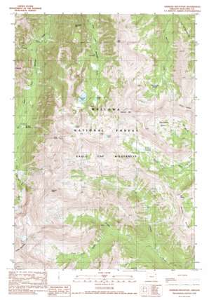
Aneroid Mountain Topo Map Oregon
To zoom in, hover over the map of Aneroid Mountain
USGS Topo Quad 45117b2 - 1:24,000 scale
| Topo Map Name: | Aneroid Mountain |
| USGS Topo Quad ID: | 45117b2 |
| Print Size: | ca. 21 1/4" wide x 27" high |
| Southeast Coordinates: | 45.125° N latitude / 117.125° W longitude |
| Map Center Coordinates: | 45.1875° N latitude / 117.1875° W longitude |
| U.S. State: | OR |
| Filename: | o45117b2.jpg |
| Download Map JPG Image: | Aneroid Mountain topo map 1:24,000 scale |
| Map Type: | Topographic |
| Topo Series: | 7.5´ |
| Map Scale: | 1:24,000 |
| Source of Map Images: | United States Geological Survey (USGS) |
| Alternate Map Versions: |
Aneroid Mountain OR 1990 Download PDF Buy paper map Aneroid Mountain OR 1990, updated 1990 Download PDF Buy paper map Aneroid Mountain OR 1990, updated 1990 Download PDF Buy paper map Aneroid Mountain OR 2011 Download PDF Buy paper map Aneroid Mountain OR 2014 Download PDF Buy paper map |
| FStopo: | US Forest Service topo Aneroid Mountain is available: Download FStopo PDF Download FStopo TIF |
1:24,000 Topo Quads surrounding Aneroid Mountain
> Back to 45117a1 at 1:100,000 scale
> Back to 45116a1 at 1:250,000 scale
> Back to U.S. Topo Maps home
Aneroid Mountain topo map: Gazetteer
Aneroid Mountain: Basins
Big Sheep Basin elevation 2342m 7683′McCully Basin elevation 2407m 7896′
Aneroid Mountain: Flats
Six Mile Meadow elevation 1862m 6108′Aneroid Mountain: Gaps
Tenderfoot Pass elevation 2619m 8592′Aneroid Mountain: Lakes
Aneroid Lake elevation 2288m 7506′Bonny Lakes elevation 2369m 7772′
Dollar Lake elevation 2583m 8474′
Jewett Lake elevation 2524m 8280′
Rogers Lake elevation 2263m 7424′
Aneroid Mountain: Ridges
Wing Ridge elevation 2738m 8982′Aneroid Mountain: Streams
Adam Creek elevation 1708m 5603′Lake Creek elevation 1836m 6023′
Middle Fork Imhaha River elevation 1807m 5928′
North Fork of Middle Fork Imnaha River elevation 1922m 6305′
South Fork Middle Fork Imhaha River elevation 1924m 6312′
Aneroid Mountain: Summits
Aneroid Mountain elevation 2945m 9662′Bonneville Mountain elevation 2472m 8110′
East Peak elevation 2831m 9288′
Mount Nebo elevation 2518m 8261′
Petes Point elevation 2932m 9619′
Sentinel Peak elevation 2854m 9363′
Aneroid Mountain digital topo map on disk
Buy this Aneroid Mountain topo map showing relief, roads, GPS coordinates and other geographical features, as a high-resolution digital map file on DVD:


