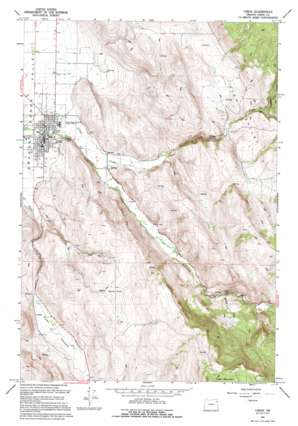
Union Topo Map Oregon
To zoom in, hover over the map of Union
USGS Topo Quad 45117b7 - 1:24,000 scale
| Topo Map Name: | Union |
| USGS Topo Quad ID: | 45117b7 |
| Print Size: | ca. 21 1/4" wide x 27" high |
| Southeast Coordinates: | 45.125° N latitude / 117.75° W longitude |
| Map Center Coordinates: | 45.1875° N latitude / 117.8125° W longitude |
| U.S. State: | OR |
| Filename: | o45117b7.jpg |
| Download Map JPG Image: | Union topo map 1:24,000 scale |
| Map Type: | Topographic |
| Topo Series: | 7.5´ |
| Map Scale: | 1:24,000 |
| Source of Map Images: | United States Geological Survey (USGS) |
| Alternate Map Versions: |
Union OR 1965, updated 1967 Download PDF Buy paper map Union OR 1994, updated 1994 Download PDF Buy paper map Union OR 2011 Download PDF Buy paper map Union OR 2014 Download PDF Buy paper map |
| FStopo: | US Forest Service topo Union is available: Download FStopo PDF Download FStopo TIF |
1:24,000 Topo Quads surrounding Union
> Back to 45117a1 at 1:100,000 scale
> Back to 45116a1 at 1:250,000 scale
> Back to U.S. Topo Maps home
Union topo map: Gazetteer
Union: Canals
Catherine Creek Highline Canal elevation 847m 2778′Elmer Ditch elevation 1092m 3582′
Prescott Ditch elevation 861m 2824′
Union: Flats
Ramo Flat elevation 1168m 3832′Union: Parks
Eastern Oregon Livestock Exposition Grounds elevation 855m 2805′Union City Park elevation 847m 2778′
Union: Populated Places
Union elevation 850m 2788′Union: Post Offices
Union Post Office elevation 850m 2788′Union: Springs
Pursel Spring elevation 1075m 3526′Wigglesworth Spring elevation 1123m 3684′
Union: Streams
Brinker Creek elevation 942m 3090′Draper Creek elevation 1092m 3582′
Kelly Springs Creek elevation 869m 2851′
Potters Creek elevation 1053m 3454′
Union: Valleys
Dry Gulch elevation 1011m 3316′Pyles Canyon elevation 861m 2824′
Union digital topo map on disk
Buy this Union topo map showing relief, roads, GPS coordinates and other geographical features, as a high-resolution digital map file on DVD:


