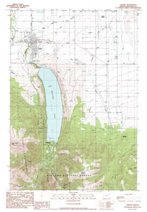
Joseph Topo Map Oregon
To zoom in, hover over the map of Joseph
USGS Topo Quad 45117c2 - 1:24,000 scale
| Topo Map Name: | Joseph |
| USGS Topo Quad ID: | 45117c2 |
| Print Size: | ca. 21 1/4" wide x 27" high |
| Southeast Coordinates: | 45.25° N latitude / 117.125° W longitude |
| Map Center Coordinates: | 45.3125° N latitude / 117.1875° W longitude |
| U.S. State: | OR |
| Filename: | o45117c2.jpg |
| Download Map JPG Image: | Joseph topo map 1:24,000 scale |
| Map Type: | Topographic |
| Topo Series: | 7.5´ |
| Map Scale: | 1:24,000 |
| Source of Map Images: | United States Geological Survey (USGS) |
| Alternate Map Versions: |
Joseph OR 1990, updated 1990 Download PDF Buy paper map Joseph OR 1990, updated 1990 Download PDF Buy paper map Joseph OR 2011 Download PDF Buy paper map Joseph OR 2014 Download PDF Buy paper map |
| FStopo: | US Forest Service topo Joseph is available: Download FStopo PDF Download FStopo TIF |
1:24,000 Topo Quads surrounding Joseph
> Back to 45117a1 at 1:100,000 scale
> Back to 45116a1 at 1:250,000 scale
> Back to U.S. Topo Maps home
Joseph topo map: Gazetteer
Joseph: Canals
Big Bend Ditch elevation 1265m 4150′Coye Ditch elevation 1302m 4271′
Farmers Ditch elevation 1284m 4212′
Moonshine Ditch elevation 1355m 4445′
Silver Lake Ditch elevation 1297m 4255′
Wrenn Dobbin Ditch elevation 1255m 4117′
Joseph: Dams
Wallowa Lake Dam elevation 1334m 4376′Joseph: Falls
Wallowa Falls elevation 1463m 4799′Joseph: Lakes
Knights Pond elevation 1329m 4360′Joseph: Mines
Royal Purple Mine elevation 1957m 6420′Transvaal Mines elevation 2273m 7457′
Joseph: Parks
Wallowa Lake State Park elevation 1420m 4658′Joseph: Populated Places
Joseph elevation 1276m 4186′Joseph: Post Offices
Joseph Post Office elevation 1276m 4186′Prairie Creek Post Office (historical) elevation 1379m 4524′
Joseph: Reservoirs
Wallowa Lake elevation 1334m 4376′Joseph: Ridges
Ferguson Ridge elevation 2125m 6971′Joseph: Springs
Roudoth Spring elevation 2190m 7185′Joseph: Streams
B C Creek elevation 1412m 4632′Bug Creek elevation 2034m 6673′
East Fork Wallowa River elevation 1372m 4501′
Johnson Creek elevation 1554m 5098′
Royal Purple Creek elevation 1776m 5826′
Spring Creek elevation 1496m 4908′
Standley Creek elevation 1816m 5958′
West Fork Prairie Creek elevation 1321m 4333′
West Fork Wallowa River elevation 1387m 4550′
Joseph: Summits
Mount Howard elevation 2512m 8241′Joseph digital topo map on disk
Buy this Joseph topo map showing relief, roads, GPS coordinates and other geographical features, as a high-resolution digital map file on DVD:


