Conley Topo Map Oregon
To zoom in, hover over the map of Conley
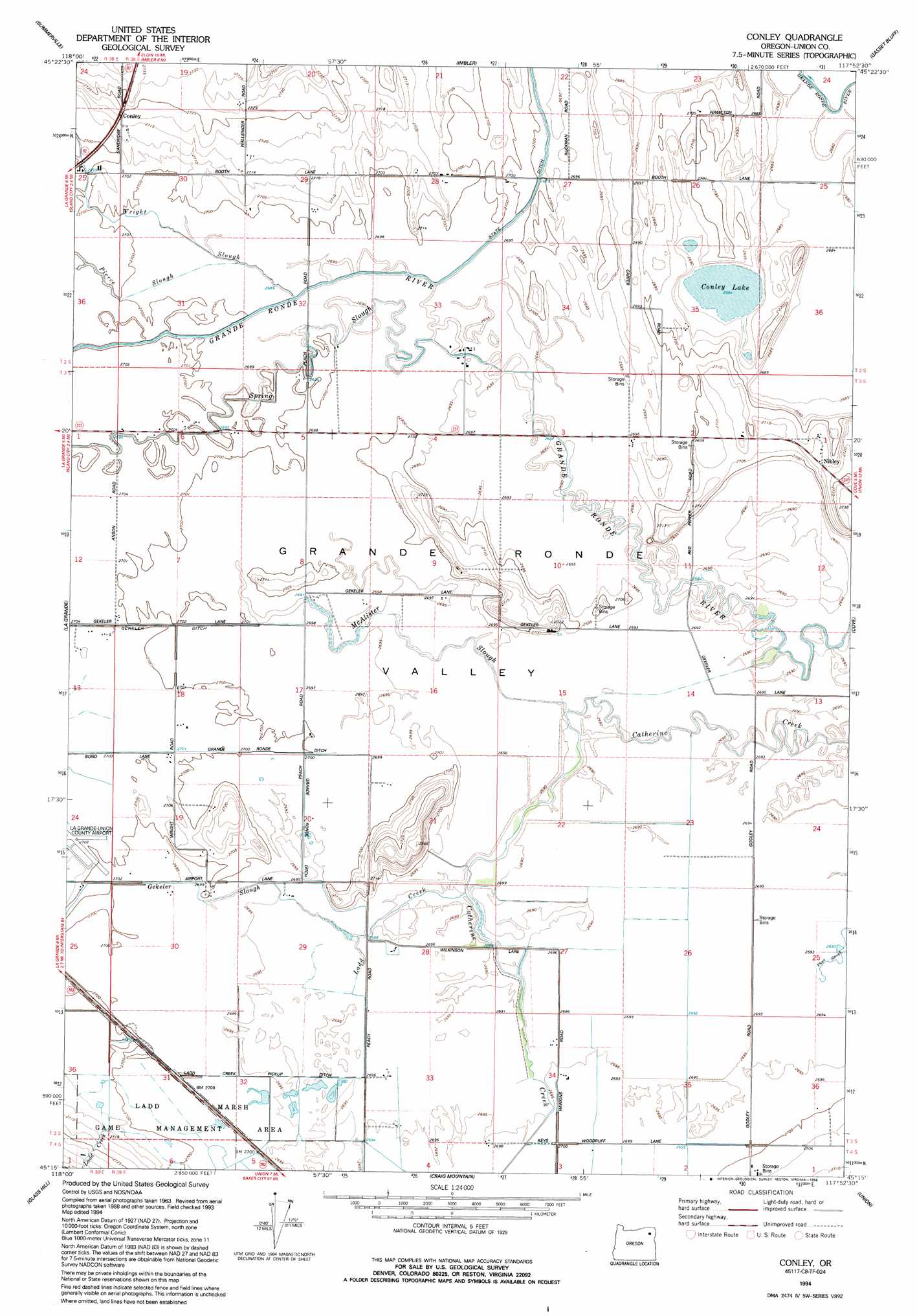
USGS Topo Quad 45117c8 - 1:24,000 scale
| Topo Map Name: | Conley |
| USGS Topo Quad ID: | 45117c8 |
| Print Size: | ca. 21 1/4" wide x 27" high |
| Southeast Coordinates: | 45.25° N latitude / 117.875° W longitude |
| Map Center Coordinates: | 45.3125° N latitude / 117.9375° W longitude |
| U.S. State: | OR |
| Filename: | o45117c8.jpg |
| Download Map JPG Image: | Conley topo map 1:24,000 scale |
| Map Type: | Topographic |
| Topo Series: | 7.5´ |
| Map Scale: | 1:24,000 |
| Source of Map Images: | United States Geological Survey (USGS) |
| Alternate Map Versions: |
Conley OR 1965, updated 1967 Download PDF Buy paper map Conley OR 1994, updated 1994 Download PDF Buy paper map Conley OR 2011 Download PDF Buy paper map Conley OR 2014 Download PDF Buy paper map |
| FStopo: | US Forest Service topo Conley is available: Download FStopo PDF Download FStopo TIF |
1:24,000 Topo Quads surrounding Conley
Thimbleberry Mountain |
Sanderson Spring |
Elgin |
Cricket Flat |
Minam |
Drumhill Ridge |
Summerville |
Imbler |
Gassett Bluff |
Mount Moriah |
Hilgard |
La Grande |
Conley |
Cove |
Mount Fanny |
La Grande Reservoir |
Glass Hill |
Craig Mountain |
Union |
Little Catherine Creek |
Anthony Butte |
Tucker Flat |
North Powder |
Telocaset |
Medical Springs |
> Back to 45117a1 at 1:100,000 scale
> Back to 45116a1 at 1:250,000 scale
> Back to U.S. Topo Maps home
Conley topo map: Gazetteer
Conley: Basins
Grande Ronde Valley elevation 823m 2700′Conley: Canals
Ladd Creek Pickup Ditch elevation 822m 2696′McAlister Ditch elevation 824m 2703′
Conley: Lakes
Conley Lake elevation 819m 2687′Conley: Post Offices
Nibley Post Office (historical) elevation 827m 2713′Conley: Streams
Gekeler Slough elevation 821m 2693′Ladd Creek elevation 821m 2693′
McAlister Slough elevation 821m 2693′
Pierce Slough elevation 819m 2687′
Spring Slough elevation 822m 2696′
Wright Slough elevation 823m 2700′
Conley digital topo map on disk
Buy this Conley topo map showing relief, roads, GPS coordinates and other geographical features, as a high-resolution digital map file on DVD: