Three Lakes Country Topo Map Oregon
To zoom in, hover over the map of Three Lakes Country
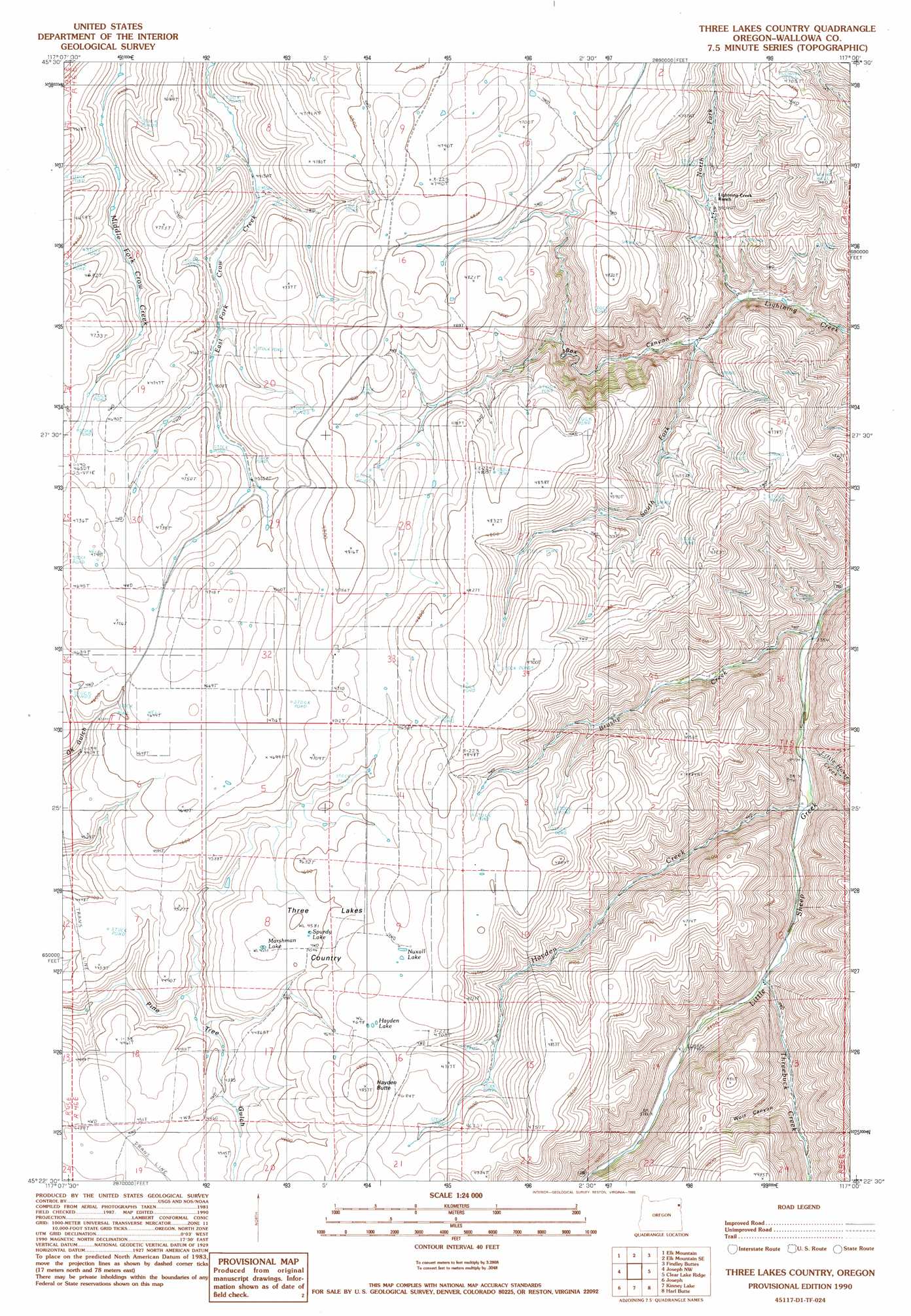
USGS Topo Quad 45117d1 - 1:24,000 scale
| Topo Map Name: | Three Lakes Country |
| USGS Topo Quad ID: | 45117d1 |
| Print Size: | ca. 21 1/4" wide x 27" high |
| Southeast Coordinates: | 45.375° N latitude / 117° W longitude |
| Map Center Coordinates: | 45.4375° N latitude / 117.0625° W longitude |
| U.S. State: | OR |
| Filename: | o45117d1.jpg |
| Download Map JPG Image: | Three Lakes Country topo map 1:24,000 scale |
| Map Type: | Topographic |
| Topo Series: | 7.5´ |
| Map Scale: | 1:24,000 |
| Source of Map Images: | United States Geological Survey (USGS) |
| Alternate Map Versions: |
Three Lakes Country OR 1990, updated 1990 Download PDF Buy paper map Three Lakes Country OR 2011 Download PDF Buy paper map Three Lakes Country OR 2014 Download PDF Buy paper map |
| FStopo: | US Forest Service topo Three Lakes Country is available: Download FStopo PDF Download FStopo TIF |
1:24,000 Topo Quads surrounding Three Lakes Country
Sled Springs |
Starvation Ridge |
Greenwood Butte |
Zumwalt |
Haas Hollow |
Hicks Spring |
Elk Mountain |
Elk Mountain Se |
Findley Buttes |
Imnaha |
Enterprise |
Joseph Nw |
Three Lakes Country |
Clear Lake Ridge |
Sheep Creek Divide |
Chief Joseph Mountain |
Joseph |
Kinney Lake |
Harl Butte |
Jaynes Ridge |
Eagle Cap |
Aneroid Mountain |
Lick Creek |
Gumboot Butte |
Puderbaugh Ridge |
> Back to 45117a1 at 1:100,000 scale
> Back to 45116a1 at 1:250,000 scale
> Back to U.S. Topo Maps home
Three Lakes Country topo map: Gazetteer
Three Lakes Country: Areas
Three Lakes Country elevation 1425m 4675′Three Lakes Country: Lakes
Hayden Lake elevation 1436m 4711′Marshman Lake elevation 1391m 4563′
Nuxall Lake elevation 1436m 4711′
Sprudy Lake elevation 1399m 4589′
Three Lakes Country: Streams
Brushy Creek elevation 1022m 3353′Hayden Creek elevation 1064m 3490′
Little Horse Creek elevation 1052m 3451′
North Fork Lightning Creek elevation 1083m 3553′
South Fork Lightning Creek elevation 1104m 3622′
Threebuck Creek elevation 1117m 3664′
Three Lakes Country: Summits
Hayden Butte elevation 1481m 4858′Three Lakes Country: Valleys
Box Canyon elevation 1104m 3622′Wolf Canyon elevation 1222m 4009′
Three Lakes Country digital topo map on disk
Buy this Three Lakes Country topo map showing relief, roads, GPS coordinates and other geographical features, as a high-resolution digital map file on DVD: