Fox Point Topo Map Oregon
To zoom in, hover over the map of Fox Point
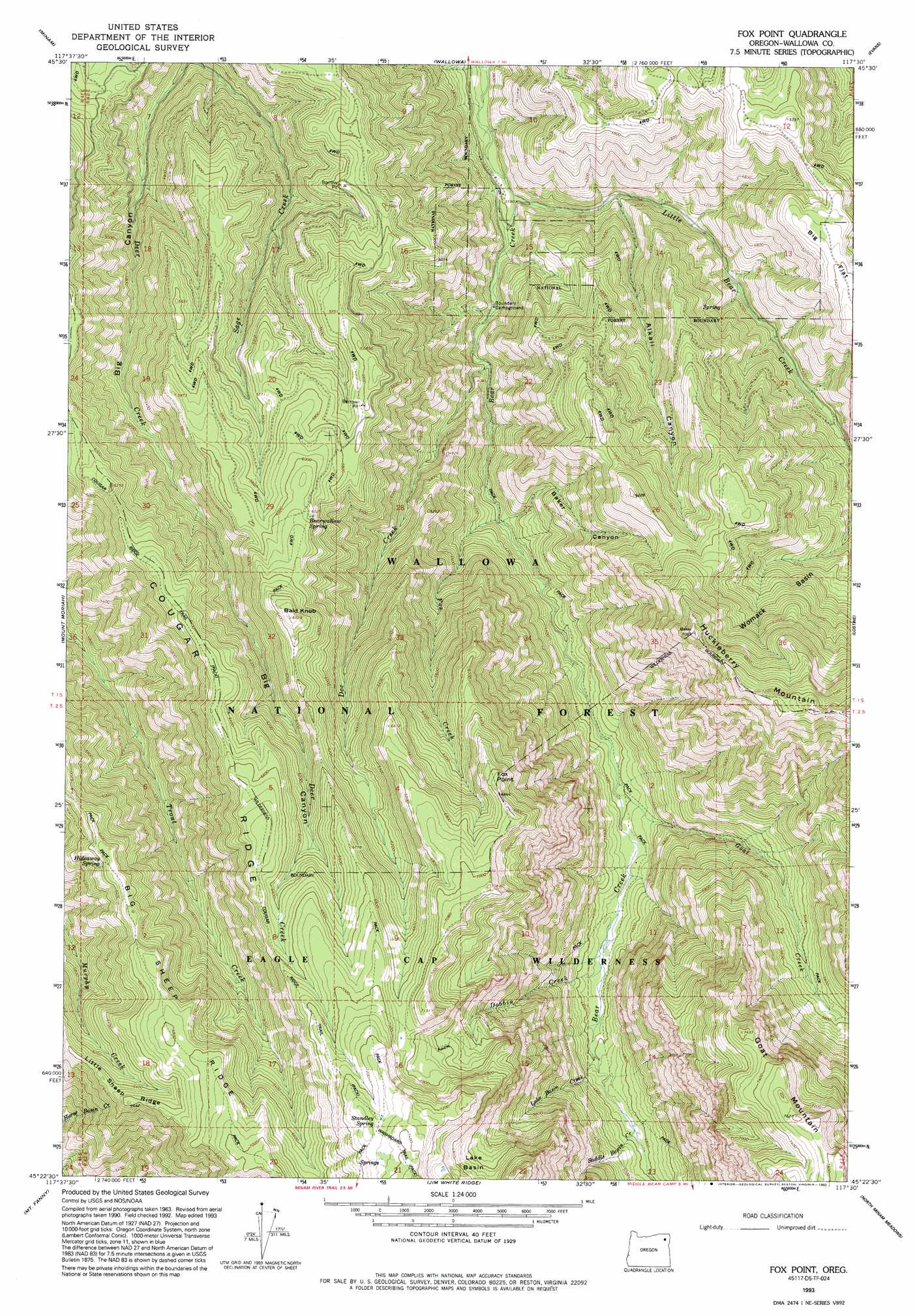
USGS Topo Quad 45117d5 - 1:24,000 scale
| Topo Map Name: | Fox Point |
| USGS Topo Quad ID: | 45117d5 |
| Print Size: | ca. 21 1/4" wide x 27" high |
| Southeast Coordinates: | 45.375° N latitude / 117.5° W longitude |
| Map Center Coordinates: | 45.4375° N latitude / 117.5625° W longitude |
| U.S. State: | OR |
| Filename: | o45117d5.jpg |
| Download Map JPG Image: | Fox Point topo map 1:24,000 scale |
| Map Type: | Topographic |
| Topo Series: | 7.5´ |
| Map Scale: | 1:24,000 |
| Source of Map Images: | United States Geological Survey (USGS) |
| Alternate Map Versions: |
Fox Point OR 1965, updated 1967 Download PDF Buy paper map Fox Point OR 1965, updated 1985 Download PDF Buy paper map Fox Point OR 1993, updated 1993 Download PDF Buy paper map Fox Point OR 2011 Download PDF Buy paper map Fox Point OR 2014 Download PDF Buy paper map |
| FStopo: | US Forest Service topo Fox Point is available: Download FStopo PDF Download FStopo TIF |
1:24,000 Topo Quads surrounding Fox Point
Rondowa |
Howard Butte |
Akers Butte |
Washboard Ridge |
Sled Springs |
Cricket Flat |
Minam |
Wallowa |
Evans |
Hicks Spring |
Gassett Bluff |
Mount Moriah |
Fox Point |
Lostine |
Enterprise |
Cove |
Mount Fanny |
Jim White Ridge |
North Minam Meadows |
Chief Joseph Mountain |
Union |
Little Catherine Creek |
China Cap |
Steamboat Lake |
Eagle Cap |
> Back to 45117a1 at 1:100,000 scale
> Back to 45116a1 at 1:250,000 scale
> Back to U.S. Topo Maps home
Fox Point topo map: Gazetteer
Fox Point: Basins
Lake Basin elevation 2056m 6745′Womack Basin elevation 1685m 5528′
Fox Point: Cliffs
Fox Point elevation 2092m 6863′Fox Point: Flats
Big Flat elevation 1638m 5374′Fox Point: Springs
Bearwallow Spring elevation 1826m 5990′Goat Mountain Spring elevation 2146m 7040′
Hideaway Spring elevation 1935m 6348′
Standley Spring elevation 2217m 7273′
Fox Point: Streams
Dobbin Creek elevation 1373m 4504′Doc Creek elevation 1173m 3848′
Fox Creek elevation 1219m 3999′
Goat Creek elevation 1330m 4363′
Lake Basin Creek elevation 1400m 4593′
Little Bear Creek elevation 1094m 3589′
Saddle Basin Creek elevation 1449m 4753′
Fox Point: Summits
Bald Knob elevation 1992m 6535′Fox Point: Valleys
Alkali Canyon elevation 1150m 3772′Baker Canyon elevation 1232m 4041′
Fox Point digital topo map on disk
Buy this Fox Point topo map showing relief, roads, GPS coordinates and other geographical features, as a high-resolution digital map file on DVD: