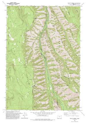
Mount Moriah Topo Map Oregon
To zoom in, hover over the map of Mount Moriah
USGS Topo Quad 45117d6 - 1:24,000 scale
| Topo Map Name: | Mount Moriah |
| USGS Topo Quad ID: | 45117d6 |
| Print Size: | ca. 21 1/4" wide x 27" high |
| Southeast Coordinates: | 45.375° N latitude / 117.625° W longitude |
| Map Center Coordinates: | 45.4375° N latitude / 117.6875° W longitude |
| U.S. State: | OR |
| Filename: | o45117d6.jpg |
| Download Map JPG Image: | Mount Moriah topo map 1:24,000 scale |
| Map Type: | Topographic |
| Topo Series: | 7.5´ |
| Map Scale: | 1:24,000 |
| Source of Map Images: | United States Geological Survey (USGS) |
| Alternate Map Versions: |
Mount Moriah OR 1965, updated 1967 Download PDF Buy paper map Mount Moriah OR 1965, updated 1985 Download PDF Buy paper map Mount Moriah OR 1993, updated 1993 Download PDF Buy paper map Mount Moriah OR 2011 Download PDF Buy paper map Mount Moriah OR 2014 Download PDF Buy paper map |
| FStopo: | US Forest Service topo Mount Moriah is available: Download FStopo PDF Download FStopo TIF |
1:24,000 Topo Quads surrounding Mount Moriah
> Back to 45117a1 at 1:100,000 scale
> Back to 45116a1 at 1:250,000 scale
> Back to U.S. Topo Maps home
Mount Moriah topo map: Gazetteer
Mount Moriah: Capes
Monument Point elevation 1967m 6453′Mount Moriah: Flats
Horse Meadow elevation 1777m 5830′Mount Moriah: Ridges
Big Sheep Ridge elevation 1879m 6164′Cougar Ridge elevation 1787m 5862′
High Ridge elevation 1645m 5396′
Little Sheep Ridge elevation 1600m 5249′
Mahogany Ridge elevation 1771m 5810′
Mount Moriah: Springs
Burnt Spring elevation 1734m 5688′Chicken Spring elevation 1707m 5600′
Coyote Spring elevation 1402m 4599′
Jim Spring elevation 1559m 5114′
Moonrise Spring elevation 1817m 5961′
Rock Spring elevation 1747m 5731′
Twin Spring elevation 1560m 5118′
Mount Moriah: Streams
Bluch Creek elevation 1053m 3454′Dunning Creek elevation 1258m 4127′
Eagle Creek elevation 950m 3116′
Faun Creek elevation 1035m 3395′
Grouse Creek elevation 1084m 3556′
Horse Basin Creek elevation 1072m 3517′
Little Minam River elevation 1035m 3395′
Lobo Creek elevation 1011m 3316′
Murphy Creek elevation 979m 3211′
Mount Moriah: Summits
Collusion Point elevation 1448m 4750′Line Bluff elevation 1836m 6023′
Mount Moriah elevation 1640m 5380′
Trippier Point elevation 1830m 6003′
Mount Moriah: Trails
Cougar Ridge Trail elevation 1732m 5682′Crooked Trail elevation 1714m 5623′
Rock Spring Trail elevation 1342m 4402′
Mount Moriah: Valleys
Division Gulch elevation 1149m 3769′Mount Moriah digital topo map on disk
Buy this Mount Moriah topo map showing relief, roads, GPS coordinates and other geographical features, as a high-resolution digital map file on DVD:


