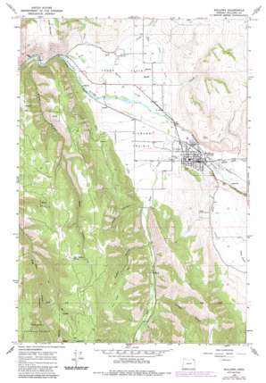
Wallowa Topo Map Oregon
To zoom in, hover over the map of Wallowa
USGS Topo Quad 45117e5 - 1:24,000 scale
| Topo Map Name: | Wallowa |
| USGS Topo Quad ID: | 45117e5 |
| Print Size: | ca. 21 1/4" wide x 27" high |
| Southeast Coordinates: | 45.5° N latitude / 117.5° W longitude |
| Map Center Coordinates: | 45.5625° N latitude / 117.5625° W longitude |
| U.S. State: | OR |
| Filename: | o45117e5.jpg |
| Download Map JPG Image: | Wallowa topo map 1:24,000 scale |
| Map Type: | Topographic |
| Topo Series: | 7.5´ |
| Map Scale: | 1:24,000 |
| Source of Map Images: | United States Geological Survey (USGS) |
| Alternate Map Versions: |
Wallowa OR 1964, updated 1966 Download PDF Buy paper map Wallowa OR 1964, updated 1985 Download PDF Buy paper map Wallowa OR 2011 Download PDF Buy paper map Wallowa OR 2014 Download PDF Buy paper map |
| FStopo: | US Forest Service topo Wallowa is available: Download FStopo PDF Download FStopo TIF |
1:24,000 Topo Quads surrounding Wallowa
> Back to 45117e1 at 1:100,000 scale
> Back to 45116a1 at 1:250,000 scale
> Back to U.S. Topo Maps home
Wallowa topo map: Gazetteer
Wallowa: Airports
Sasser Landing Strip elevation 985m 3231′Wallowa: Basins
Lower Valley elevation 857m 2811′Wallowa: Canals
Chamberlin Ditch elevation 907m 2975′Clear Water Ditch elevation 943m 3093′
Lower Valley Ditch elevation 873m 2864′
Wallowa: Flats
Diamond Prairie elevation 895m 2936′Elk Flat elevation 1420m 4658′
Wallowa: Parks
Evans Park elevation 896m 2939′Wallowa: Populated Places
Wallowa elevation 895m 2936′Wallowa: Post Offices
Wallowa Post Office elevation 895m 2936′Wallowa: Reservoirs
Maxwell Pond elevation 899m 2949′Wallowa: Springs
Bear Wallow Spring elevation 1488m 4881′Wallowa: Streams
Bear Creek elevation 878m 2880′Boyd Creek elevation 846m 2775′
Dry Creek elevation 842m 2762′
Rock Creek elevation 842m 2762′
Sage Creek elevation 1263m 4143′
Shell Creek elevation 880m 2887′
Spring Creek elevation 871m 2857′
Whisky Creek elevation 892m 2926′
Wallowa: Summits
Tick Hill elevation 1077m 3533′Wallowa: Valleys
Garden Gulch elevation 1018m 3339′Goebel Canyon elevation 984m 3228′
Hays Canyon elevation 951m 3120′
Water Canyon elevation 839m 2752′
Wallowa digital topo map on disk
Buy this Wallowa topo map showing relief, roads, GPS coordinates and other geographical features, as a high-resolution digital map file on DVD:


