Teepee Butte Topo Map Oregon
To zoom in, hover over the map of Teepee Butte
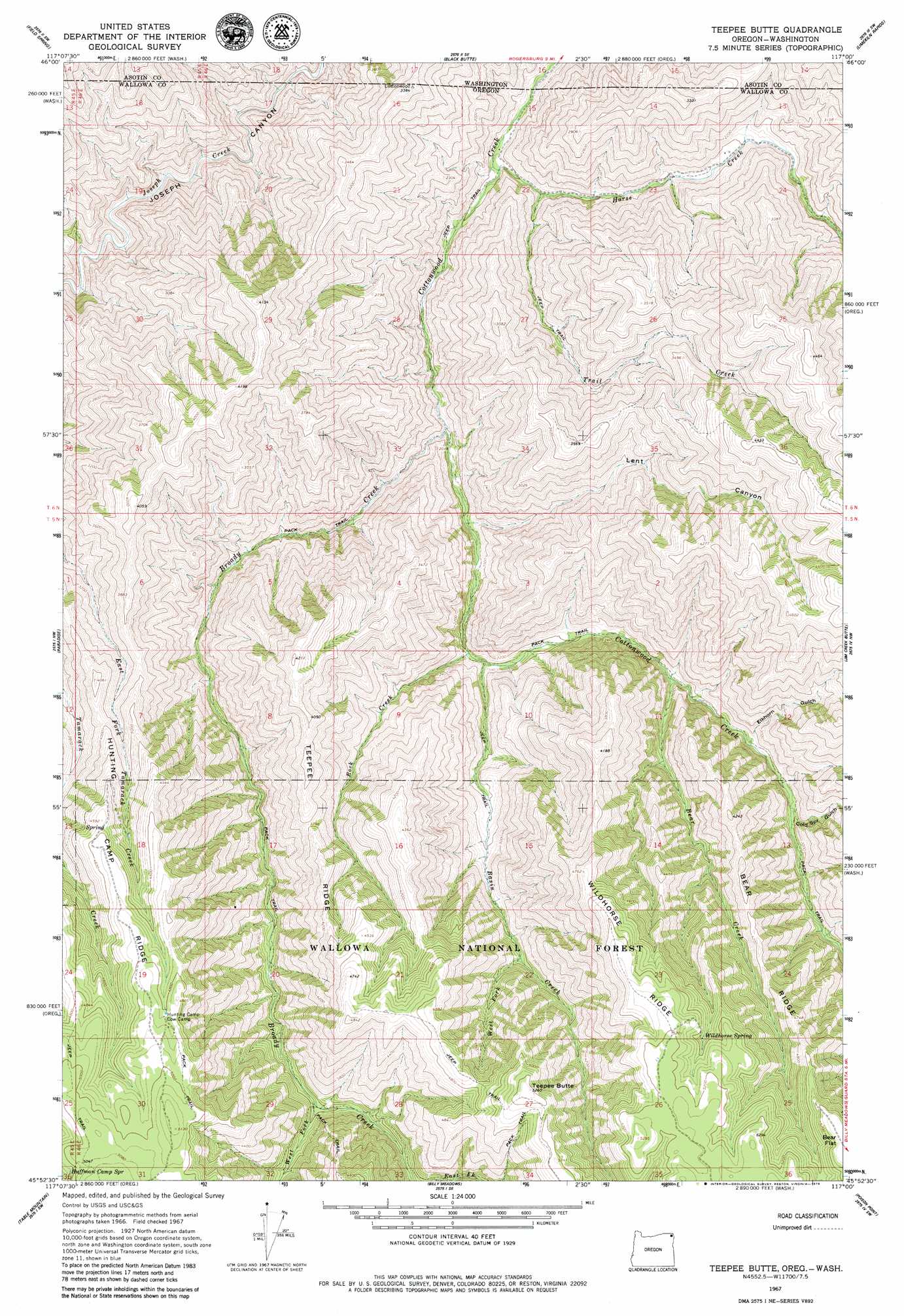
USGS Topo Quad 45117h1 - 1:24,000 scale
| Topo Map Name: | Teepee Butte |
| USGS Topo Quad ID: | 45117h1 |
| Print Size: | ca. 21 1/4" wide x 27" high |
| Southeast Coordinates: | 45.875° N latitude / 117° W longitude |
| Map Center Coordinates: | 45.9375° N latitude / 117.0625° W longitude |
| U.S. States: | OR, WA |
| Filename: | o45117h1.jpg |
| Download Map JPG Image: | Teepee Butte topo map 1:24,000 scale |
| Map Type: | Topographic |
| Topo Series: | 7.5´ |
| Map Scale: | 1:24,000 |
| Source of Map Images: | United States Geological Survey (USGS) |
| Alternate Map Versions: |
Teepee Butte OR 1967, updated 1971 Download PDF Buy paper map Teepee Butte OR 2011 Download PDF Buy paper map Teepee Butte OR 2014 Download PDF Buy paper map |
| FStopo: | US Forest Service topo Teepee Butte is available: Download FStopo PDF Download FStopo TIF |
1:24,000 Topo Quads surrounding Teepee Butte
Harlow Ridge |
Anatone |
Weissenfels Ridge |
Captain John Rapids |
Waha |
Mountain View |
Fields Spring |
Black Butte |
Limekiln Rapids |
Frye Point |
Flora |
Paradise |
Teepee Butte |
Jim Creek Butte |
Wapshilla Creek |
Shamrock Creek |
Table Mountain |
Billy Meadows |
Poison Point |
Deadhorse Ridge |
Sled Springs |
Starvation Ridge |
Greenwood Butte |
Zumwalt |
Haas Hollow |
> Back to 45117e1 at 1:100,000 scale
> Back to 45116a1 at 1:250,000 scale
> Back to U.S. Topo Maps home
Teepee Butte topo map: Gazetteer
Teepee Butte: Flats
Bear Flat elevation 1613m 5291′Teepee Butte: Ridges
Bear Ridge elevation 1288m 4225′Hunting Camp Ridge elevation 1431m 4694′
Teepee Ridge elevation 1151m 3776′
Wildhorse Ridge elevation 1541m 5055′
Teepee Butte: Springs
Huffman Camp Spring elevation 1510m 4954′Wildhorse Spring elevation 1497m 4911′
Teepee Butte: Streams
Basin Creek elevation 644m 2112′Bear Creek elevation 774m 2539′
Broady Creek elevation 538m 1765′
Brushy Creek elevation 760m 2493′
Horse Creek elevation 415m 1361′
Rock Creek elevation 614m 2014′
Trail Creek elevation 477m 1564′
West Fork Basin Creek elevation 1022m 3353′
West Fork Broady Creek elevation 1030m 3379′
Teepee Butte: Summits
Teepee Butte elevation 1601m 5252′Teepee Butte: Valleys
Cold Spring Gulch elevation 870m 2854′Elkhorn Gulch elevation 823m 2700′
Lent Canyon elevation 556m 1824′
Teepee Butte digital topo map on disk
Buy this Teepee Butte topo map showing relief, roads, GPS coordinates and other geographical features, as a high-resolution digital map file on DVD: