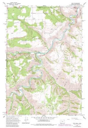
Troy Topo Map Oregon
To zoom in, hover over the map of Troy
USGS Topo Quad 45117h4 - 1:24,000 scale
| Topo Map Name: | Troy |
| USGS Topo Quad ID: | 45117h4 |
| Print Size: | ca. 21 1/4" wide x 27" high |
| Southeast Coordinates: | 45.875° N latitude / 117.375° W longitude |
| Map Center Coordinates: | 45.9375° N latitude / 117.4375° W longitude |
| U.S. States: | OR, WA |
| Filename: | o45117h4.jpg |
| Download Map JPG Image: | Troy topo map 1:24,000 scale |
| Map Type: | Topographic |
| Topo Series: | 7.5´ |
| Map Scale: | 1:24,000 |
| Source of Map Images: | United States Geological Survey (USGS) |
| Alternate Map Versions: |
Troy OR 1967, updated 1971 Download PDF Buy paper map Troy OR 1967, updated 1983 Download PDF Buy paper map Troy OR 1995, updated 1998 Download PDF Buy paper map Troy OR 2011 Download PDF Buy paper map Troy OR 2014 Download PDF Buy paper map |
| FStopo: | US Forest Service topo Troy is available: Download FStopo PDF Download FStopo TIF |
1:24,000 Topo Quads surrounding Troy
> Back to 45117e1 at 1:100,000 scale
> Back to 45116a1 at 1:250,000 scale
> Back to U.S. Topo Maps home
Troy topo map: Gazetteer
Troy: Benches
Barlett Bench elevation 1086m 3562′Bartlett Bench elevation 843m 2765′
Troy: Flats
Grouse Flat elevation 1064m 3490′Lightle Flat elevation 808m 2650′
Troy: Populated Places
Bartlett elevation 1067m 3500′Grouse elevation 919m 3015′
Troy elevation 495m 1624′
Troy: Post Offices
Bartlett Post Office (historical) elevation 1067m 3500′Grouse Post Office (historical) elevation 919m 3015′
Lyman Post Office (historical) elevation 975m 3198′
Powwatka Post Office (historical) elevation 971m 3185′
Troy Post Office (historical) elevation 495m 1624′
Troy: Ridges
Horseshoe Ridge elevation 596m 1955′Long Point elevation 923m 3028′
Troy: Springs
Colpitts Spring elevation 967m 3172′McNeils Spring elevation 954m 3129′
Troy: Streams
Bear Creek elevation 481m 1578′Bear Creek elevation 478m 1568′
Courtney Creek elevation 490m 1607′
Grouse Creek elevation 461m 1512′
Grouse Creek elevation 455m 1492′
Mud Creek elevation 521m 1709′
Sheep Creek elevation 565m 1853′
Sheep Creek elevation 556m 1824′
Wenaha River elevation 488m 1601′
Wildcat Creek elevation 529m 1735′
Troy: Valleys
Dry Gulch elevation 533m 1748′Little Courtney Canyon elevation 609m 1998′
Lower Trail Canyon elevation 589m 1932′
Shuman Canyon elevation 709m 2326′
Squaw Canyon elevation 469m 1538′
Whitmore Canyon elevation 592m 1942′
Troy digital topo map on disk
Buy this Troy topo map showing relief, roads, GPS coordinates and other geographical features, as a high-resolution digital map file on DVD:


