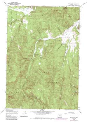
Fly Valley Topo Map Oregon
To zoom in, hover over the map of Fly Valley
USGS Topo Quad 45118a4 - 1:24,000 scale
| Topo Map Name: | Fly Valley |
| USGS Topo Quad ID: | 45118a4 |
| Print Size: | ca. 21 1/4" wide x 27" high |
| Southeast Coordinates: | 45° N latitude / 118.375° W longitude |
| Map Center Coordinates: | 45.0625° N latitude / 118.4375° W longitude |
| U.S. State: | OR |
| Filename: | o45118a4.jpg |
| Download Map JPG Image: | Fly Valley topo map 1:24,000 scale |
| Map Type: | Topographic |
| Topo Series: | 7.5´ |
| Map Scale: | 1:24,000 |
| Source of Map Images: | United States Geological Survey (USGS) |
| Alternate Map Versions: |
Fly Valley OR 1965, updated 1968 Download PDF Buy paper map Fly Valley OR 1965, updated 1984 Download PDF Buy paper map Fly Valley OR 1965, updated 1985 Download PDF Buy paper map Fly Valley OR 2011 Download PDF Buy paper map Fly Valley OR 2014 Download PDF Buy paper map |
| FStopo: | US Forest Service topo Fly Valley is available: Download FStopo PDF Download FStopo TIF |
1:24,000 Topo Quads surrounding Fly Valley
> Back to 45118a1 at 1:100,000 scale
> Back to 45118a1 at 1:250,000 scale
> Back to U.S. Topo Maps home
Fly Valley topo map: Gazetteer
Fly Valley: Airports
PUI Airstrip elevation 1320m 4330′Vey Sheep Ranch Airstrip elevation 1261m 4137′
Fly Valley: Flats
Fly Valley elevation 1325m 4347′Fly Valley: Springs
Blue Spring elevation 1348m 4422′Rock Spring elevation 1531m 5022′
Warm Mineral Spring elevation 1331m 4366′
Fly Valley: Streams
Chicken Creek elevation 1260m 4133′Dry Creek elevation 1257m 4124′
East Sheep Creek elevation 1406m 4612′
Indiana Creek elevation 1455m 4773′
Little Fly Creek elevation 1321m 4333′
Lookout Creek elevation 1341m 4399′
Sheep Creek elevation 1248m 4094′
West Chicken Creek elevation 1313m 4307′
Fly Valley digital topo map on disk
Buy this Fly Valley topo map showing relief, roads, GPS coordinates and other geographical features, as a high-resolution digital map file on DVD:


