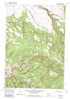
Ukiah Se Topo Map Oregon
To zoom in, hover over the map of Ukiah Se
USGS Topo Quad 45118a7 - 1:24,000 scale
| Topo Map Name: | Ukiah Se |
| USGS Topo Quad ID: | 45118a7 |
| Print Size: | ca. 21 1/4" wide x 27" high |
| Southeast Coordinates: | 45° N latitude / 118.75° W longitude |
| Map Center Coordinates: | 45.0625° N latitude / 118.8125° W longitude |
| U.S. State: | OR |
| Filename: | o45118a7.jpg |
| Download Map JPG Image: | Ukiah Se topo map 1:24,000 scale |
| Map Type: | Topographic |
| Topo Series: | 7.5´ |
| Map Scale: | 1:24,000 |
| Source of Map Images: | United States Geological Survey (USGS) |
| Alternate Map Versions: |
Ukiah SE OR 1967, updated 1969 Download PDF Buy paper map Ukiah SE OR 1967, updated 1984 Download PDF Buy paper map Ukiah SE OR 1995, updated 1998 Download PDF Buy paper map Ukiah SE OR 2011 Download PDF Buy paper map Ukiah SE OR 2014 Download PDF Buy paper map |
| FStopo: | US Forest Service topo Ukiah SE is available: Download FStopo PDF Download FStopo TIF |
1:24,000 Topo Quads surrounding Ukiah Se
> Back to 45118a1 at 1:100,000 scale
> Back to 45118a1 at 1:250,000 scale
> Back to U.S. Topo Maps home
Ukiah Se topo map: Gazetteer
Ukiah Se: Springs
Basin Spring elevation 1148m 3766′Blue Spring elevation 1424m 4671′
Hello Bay Spring elevation 1506m 4940′
Overtime Spring elevation 913m 2995′
Ross Spring elevation 1359m 4458′
Ukiah Se: Streams
Dry Creek elevation 1144m 3753′Juniper Creek elevation 938m 3077′
North Fork Cable Creek elevation 1278m 4192′
Nye Creek elevation 922m 3024′
South Fork Cable Creek elevation 1278m 4192′
Texas Bar Creek elevation 906m 2972′
Trough Creek elevation 905m 2969′
Ukiah Se: Valleys
Horse Canyon elevation 901m 2956′Meengs Canyon elevation 905m 2969′
Ukiah Se digital topo map on disk
Buy this Ukiah Se topo map showing relief, roads, GPS coordinates and other geographical features, as a high-resolution digital map file on DVD:


