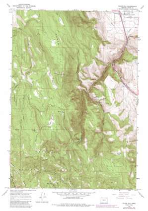
Glass Hill Topo Map Oregon
To zoom in, hover over the map of Glass Hill
USGS Topo Quad 45118b1 - 1:24,000 scale
| Topo Map Name: | Glass Hill |
| USGS Topo Quad ID: | 45118b1 |
| Print Size: | ca. 21 1/4" wide x 27" high |
| Southeast Coordinates: | 45.125° N latitude / 118° W longitude |
| Map Center Coordinates: | 45.1875° N latitude / 118.0625° W longitude |
| U.S. State: | OR |
| Filename: | o45118b1.jpg |
| Download Map JPG Image: | Glass Hill topo map 1:24,000 scale |
| Map Type: | Topographic |
| Topo Series: | 7.5´ |
| Map Scale: | 1:24,000 |
| Source of Map Images: | United States Geological Survey (USGS) |
| Alternate Map Versions: |
Glass Hill OR 1965, updated 1967 Download PDF Buy paper map Glass Hill OR 1965, updated 1985 Download PDF Buy paper map Glass Hill OR 2011 Download PDF Buy paper map Glass Hill OR 2014 Download PDF Buy paper map |
| FStopo: | US Forest Service topo Glass Hill is available: Download FStopo PDF Download FStopo TIF |
1:24,000 Topo Quads surrounding Glass Hill
> Back to 45118a1 at 1:100,000 scale
> Back to 45118a1 at 1:250,000 scale
> Back to U.S. Topo Maps home
Glass Hill topo map: Gazetteer
Glass Hill: Flats
Howard Meadow elevation 1506m 4940′Long Prairie elevation 1479m 4852′
Spring Flat elevation 1423m 4668′
Glass Hill: Lakes
Ladd Canyon Pond elevation 1291m 4235′Glass Hill: Reservoirs
Arnoldus Pond elevation 1502m 4927′Glass Hill: Ridges
Mann Ridge elevation 1582m 5190′Glass Hill: Springs
Clay Spring elevation 938m 3077′Glass Hill: Streams
East Fork Rock Creek elevation 1368m 4488′West Fork Clear Creek elevation 857m 2811′
Glass Hill: Summits
Baldy elevation 1497m 4911′Glass Hill elevation 1643m 5390′
Morris Hill elevation 1727m 5666′
Tamarack Mountain elevation 1547m 5075′
Glass Hill: Trails
Howard Meadow Trail elevation 1651m 5416′Glass Hill: Valleys
Ladd Canyon elevation 955m 3133′Glass Hill digital topo map on disk
Buy this Glass Hill topo map showing relief, roads, GPS coordinates and other geographical features, as a high-resolution digital map file on DVD:


